


Daily Weather Briefing
Sunday, October 25, 2026
ALABAMA THIS MORNING
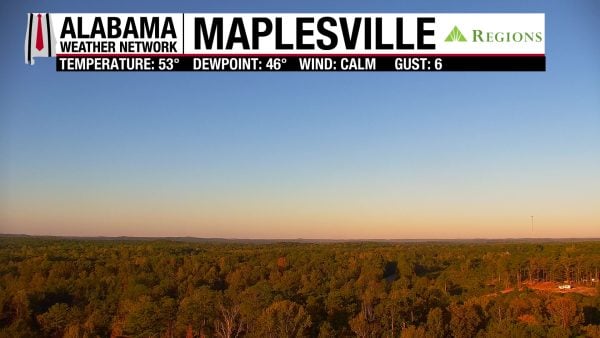
Sunday morning starts off cool, with temperatures in the mid to upper 40s in the north and west and the low 50s across the rest of the state. Skies are bright and clear, just as it looks on our Regions Skycam in Maplesville.
ALABAMA 7 DAY FORECAST
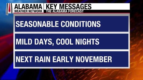
The upper-level ridge to our west and surface high pressure to our east keep Alabama mild and dry again today. The ridge will move eastward throughout the week, allowing for a slowing warming trend to occur, but rain will stay out of the forecast.
QUIET SUNDAY – Oct 25
Today’s highs will rise to the low to mid 70s across the eastern two-thirds of the state while the upper 70s to even 80 degrees are expected in the western third. Skies will be mostly clear, and winds will be in the 10-20 mph range in the southern half of the state. Wind gusts in the region will reach up to 30 mph, so extra caution should be used if burning outside today.
WARMING TREND BEGINS THIS WEEK – Oct 26-28
As mentioned above, the ridge will nudge further east this week, so highs will increase each day slowly at the start of this week.
Monday morning will see lows in the mid 40s to mid 50s, then highs will reach the mid 70s to around 80 degrees statewide. Skies will be mostly sunny, and winds will be much calmer, blowing in the 5 to 10 mph range.
Lows on Tuesday morning will range from the mid 40s to low 50s while highs reach into the upper 70s to around 80 degrees in the afternoon. These 80-degree readings are more likely in the south. Another day of mostly sunny skies and light winds is expected.
Wednesday morning won’t be as chilly, with lows in the upper 40s in the north and the low to mid 50s in the southern two-thirds of Alabama. Highs will warm to the mid 70s north and upper 70s south.
LITTLE CHANGE IN CONDITIONS FOR THE LATTER HALF OF THE WEEK – Oct 29-31
As we close out the month, little will change compared to the first half of the week. Cool lows, pleasant but slightly warm afternoons, and no rain.
Thursday’s highs will reach into the upper 70s to around 80 degrees. The 80-degree marks will be the most widespread compared to the forecast for early in the week.
Friday’s highs will also be in the upper 70s to low 80s statewide.
Halloween will be the warmest day of the week, with the low 80s dominating Alabama, although a stray upper 70-degree mark is possible in a few spots.
RAINFALL OUTLOOK
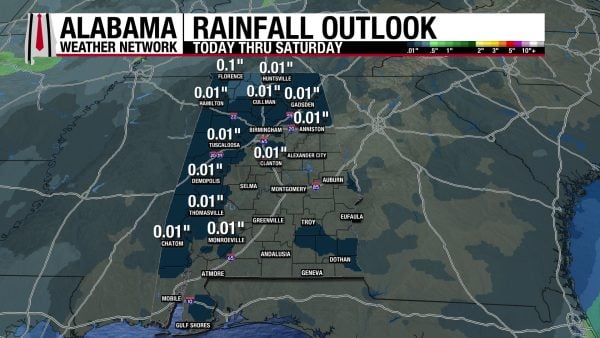
There is a chance a light shower or two could bring very low rainfall totals to the north and west portions of Alabama on Saturday, but the rest of the week will be dry.
THE ATLANTIC
There is no tropical activity in the Atlantic.
THE PACIFIC
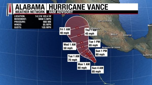
Hurricane Vance is a Category 1 storm with sustained winds of 85 mph and a central pressure of 980 mb. It is forecast to move north/northwest over the next week, staying at hurricane strength until Tuesday. Then it will be a tropical storm through the rest of the week. Interests in southwestern Mexico and on the western coast should keep an eye on the forecast. Parts of the western coast could see 2 to 4″ to up to 7″ of rain through Thursday.
ANOTHER WINDY DAY ON THE COAST
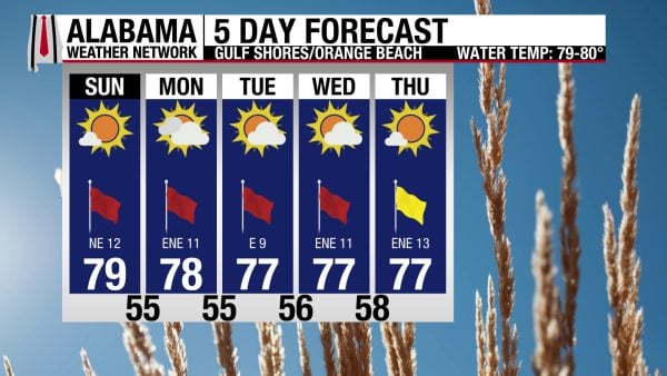
Winds from the northeast at 10-15 mph promise another windy day for the coast. These winds will also keep the rip current risk High and the surf height at 3 to 4 feet today. Skies will be sunny, the UV Index will be High, and the high will reach into the upper 70s. Windy conditions with highs in the upper 70s continue throughout the week.

WEATHERBRAINS 1084
Tomorrow’s WeatherBrains episode will feature Jeff Dobur and Molly Cornelissen, Flood Inundation Mapping experts, to explain how this process can help communities better prepare for flooding impacts. Listen to the episode wherever you get your podcasts or watch here!
TODAY IN WEATHER HISTORY
October 25, 1925 – South Alabama F4 Tornado
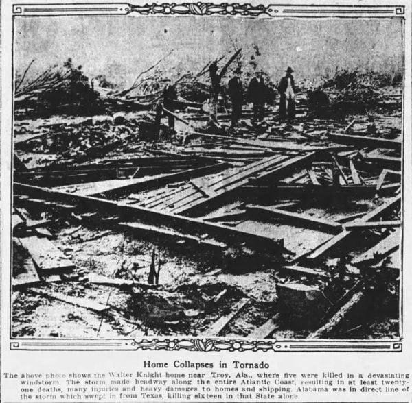
Before dawn on October 25, 1925, one of the deadliest autumn tornadoes in Alabama history swept across the southern part of the state, leaving a 65-mile trail of destruction through Crenshaw, Pike, Bullock, and Barbour Counties. Around 2 a.m., a violent tornado touched down approximately five miles north of Luverne and began moving east-northeast through the dark countryside. Eventually rated F4 on the Fujita Scale, the tornado reached a maximum width of approximately 400 yards, destroying homes, churches, schools, and farm buildings along its path. In an era before weather radar, television, or modern tornado warnings, sleeping families had little opportunity to recognize the danger approaching their communities. The storm would ultimately claim 18 lives and injure 60 people.
Some of the most heartbreaking destruction occurred near the Crenshaw–Pike County line, where the tornado struck rural communities north of Troy. In the Good Hope and Centenary communities, entire homes were swept away, leaving families buried beneath collapsed walls and scattered timbers. Among the victims were four children and their aunt, killed together when their home was destroyed. In another residence, a 105-year-old woman lost her life. At least 11 people were killed near the county line, where the tornado devastated dozens of homes and left survivors searching through wreckage in the darkness. With telephone service limited and roads obstructed by fallen trees and debris, neighbors were often the first to reach the injured and begin rescue efforts.
As the tornado continued eastward, its destructive path extended through Pike County and into Bullock County, striking small agricultural communities where homes, churches, and schools served as the centers of everyday life. At Chapel Hill, the Baptist church and schoolhouse were destroyed, while in Patsburg, powerful winds reportedly lifted a school building and carried it into a nearby river swamp. Farmhouses were reduced to splintered lumber, barns collapsed, and equipment was scattered across fields. The destruction extended into the farmland itself, where corn stalks were stripped and shredded by the tremendous winds. Contemporary descriptions told of ears of corn torn from the stalks, with kernels scattered across the ground. Such extraordinary damage illustrated the tremendous force concentrated within the tornado’s narrow but devastating path.
The tornado continued through Bullock and Barbour Counties, passing north of Troy and eventually reaching the countryside northeast of Comer before dissipating. Along the way, entire stretches of rural Alabama were transformed into scenes of devastation. Families who had gone to bed the previous evening awoke to find their homes destroyed and familiar surroundings almost unrecognizable. The disaster was especially difficult for isolated farming communities, where medical assistance and transportation were limited. Injured residents sometimes had to be carried from damaged homes or transported over obstructed roads to reach medical care. The tornado caused an estimated $250,000 in property damage, an enormous loss for the rural communities of 1925, where agriculture provided the livelihood for much of the population.
The October 25 tornado remains one of the most significant early examples of a violent autumn tornado in Alabama. According to the National Weather Service’s historical database, it was only the second October tornado documented in the state at that time, although tornado records from the early twentieth century were far less complete than those maintained today. Its F4 rating was assigned retrospectively from historical damage accounts rather than modern engineering surveys. The disaster demonstrated that Alabama’s tornado danger was not confined to spring and that powerful nighttime tornadoes could strike with devastating consequences during the fall. Nearly a century later, the 18 lives lost along that 65-mile path remain a reminder of the vulnerability of rural communities before modern warning systems, and of the extraordinary violence that can emerge from a single thunderstorm in the darkness of an October night.
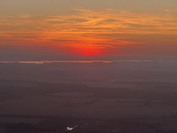
IMAGE OF THE DAY
Skywatcher Krista Hahn sent in photos of the sunset as she flew into Huntsville last night!



