


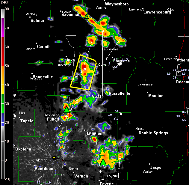
A boundary over the western part of the state is resulting in thunderstorms this afternoon.
The NWS Huntsville has issued a couple of severe thunderstorm warnings, including on that is valid right now for parts of Colbert and Franklin Counties. That storm is south of Cherokee, moving south southwest.
More storms are poised to enter Northwest Alabama from Tennessee over the next couple of hours.
Other storms are clustered over southern Marion County passing now into northern Fayette County. They extend from just south of Winfield to near Glen Allen to Bazemore then to Eldridge. These storms will affect much of Fayette County in the next couple of hours. There might be a little hail south of Winfield. There is definitely a good bit of lightning and heavy rain and gusty winds will also be a problem.
To the south, storms are over Sumter County, centered on the Livingston area.
In the Birmingham area, a light shower seemed to be forming near the Shelby County Airport. Another shower was having a hard time getting its act together over Marshall County northeast of Guntersville.
Everything is moving south southwest.



