


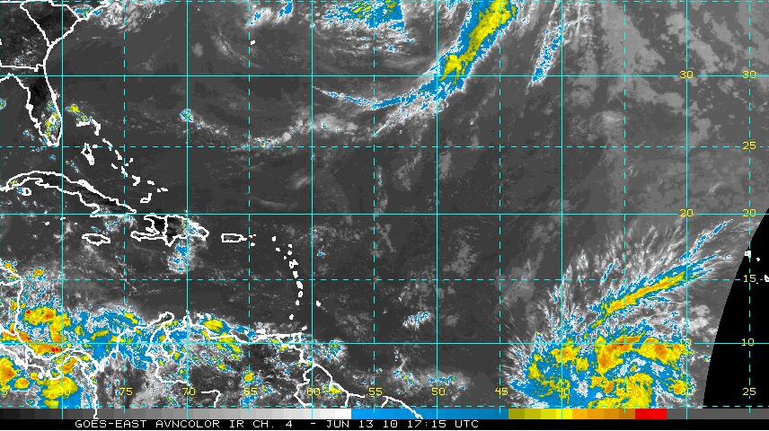
The tropical wave around 40W in the eastern Atlantic continues to become better organized and the National Hurricane Center says now that there is about a 50% chance that a tropical depression will form.
This is generally to early for systems to form in the eastern Atlantic, but sea surface temperatures are running about 4 degrees Celsius warmer than normal for this time of year. The system is not being impeded by any dry Saharan air.
It could threaten the northeastern Caribbean including the Virgin Islands late this week. No indication it would be a major storm for now. The Canadian has it the most organized. The GFS does not take it past tropical wave stage.
We will wait and see.
So, we could see our first Atlantic depression of the year in the next day or so. All indications are that it will be a long season, with the warmer than normal ocean temperatures continuing and pushing west into the Caribbean over the summer.



