


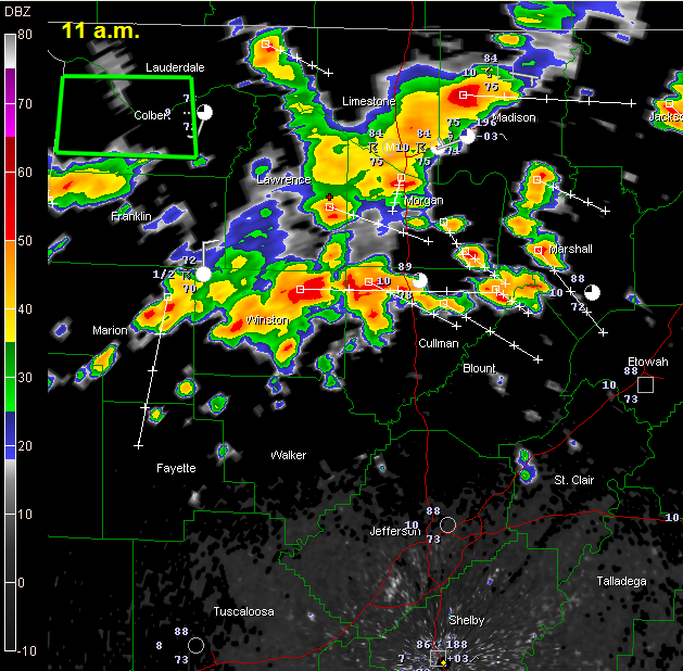
Storms have been increasing in coverage over North Alabama over the past couple of hours and dropping southward.
At this hour, the storms have made it as far south as Marion, Winston, Cullman and Marshall Counties, with a few showers breaking out over Lamar, Fayette and northwestern Walker Counties.
A shower was near Springville in St. Clair County and another near Delta in Clay County.
Heavy rain and storms extended from near Moulton to Decatur to Huntsville as well.
Temperatures were near 90F ahead of the storms.
The storms are the product of an outflow boundary from last evening’s storms over the Ohio Valley. They are finding an all you can eat buffet of unstable air across Alabama so they will continue to grow in intensity and some could produce damaging winds and very heavy rain as well as deadly lightning. (See JB’s post below that the SPC may upgrade Alabama to a slight risk and issue a severe thunderstorm watch.)
Remember that when “thunder roars, go indoors.” Next week is lightning awareness week in the U.S. Don’t be a lightning statistic.
Everything is moving southeast at about 20 mph.
In North Alabama, a flash flood warning is in effect for Colbert and southern Lauderdale Counties.



