Of course, Hurricane Dean is the big story, as it comes ashore today in the Yucatan as a very strong storm.
However, we’re still also watching the tropical wave in the western Atlantic. It is not developing much right now, with upper-level winds still strong. However, satellite wind estimates do show winds around 35 knots in parts of the system (SSMI shows ocean-surface winds, and works well only away from thunderstorms.)
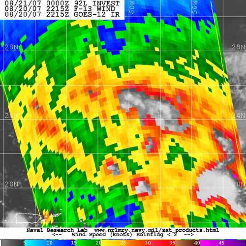
Upper-level winds are expected to weaken some this week, and this system could develop into a tropical storm by Wednesday. Some models show this system at hurricane strength by Friday. The Canadian GEM model shows the system crossing FL peninsula by Friday and coming back out into the eastern Gulf by the weekend. NAM picks up on system, GFS still doesn’t. We’ll see over the next couple of days.