


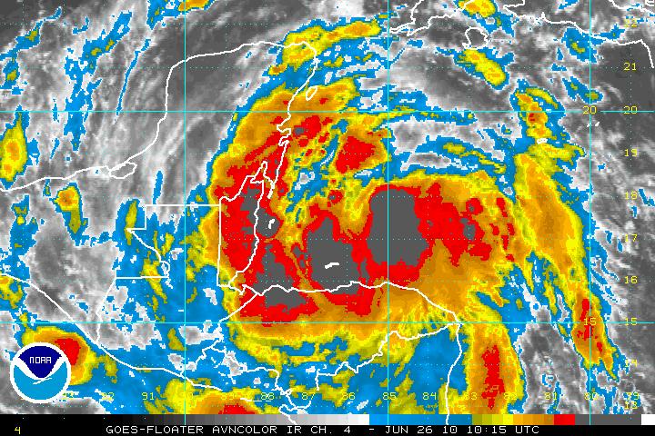
WTNT31 KNHC 260847
TCPAT1
BULLETIN
TROPICAL STORM ALEX ADVISORY NUMBER 3
NWS TPC/NATIONAL HURRICANE CENTER MIAMI FL AL012010
500 AM EDT SAT JUN 26 2010
…TROPICAL DEPRESSION ONE BECOMES TROPICAL STORM ALEX…MOVING
WEST-NORTHWESTWARD TOWARD BELIZE AND THE YUCATAN PENINSULA…
SUMMARY OF 500 AM EDT…0900 UTC…INFORMATION
———————————————-
LOCATION…16.9N 84.9W
ABOUT 220 MI…355 KM E OF BELIZE CITY
ABOUT 250 MI…400 KM ESE OF CHETUMAL MEXICO
MAXIMUM SUSTAINED WINDS…40 MPH…65 KM/HR
PRESENT MOVEMENT…WNW OR 285 DEGREES AT 8 MPH…13 KM/HR
MINIMUM CENTRAL PRESSURE…1004 MB…29.65 INCHES
Official NHC Track
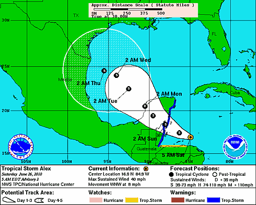
Still quite a bit of uncertainty in the track and intensity forecasts. There are two camps in the model world, with some carrying it toward the Texas/Louisiana or northern Gulf Coast, and some carrying it toward Mexico or the lower Texas Coast. We will have to wait and see.
Also, it could become a hurricane once it is back over the Gulf, although the official forecast does not call for that yet.
The NHC is also tracking a tropical wave east of the northern Leeward Islands that they say has a 20% chance of becoming a tropical cyclone as it heads northwest.



