


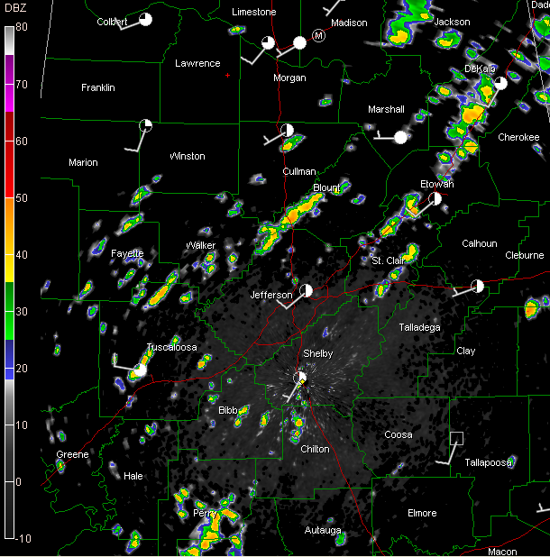
Showers are already underway across a stripe laid across the state from Northeast into West Central then down into Southwest Alabama. It looks almost like the radar is coming down with a case of measles again.
The most significant ones are west of the City of Tuscaloosa (near the Airport – where heavy rain was falling)… over extreme Northwest Jefferson and southern Blount counties… over St. Clair County west of Ragland… south of Steele straddling I-59 in Etowah County… near Collinsville in Northeast Alabama… and between Vinemont and Cullman in Cullman County.
Some lightning was noted a short while ago near Smoke Rise in southern Blount County.
Instabilities are actually running a little higher than yesterday, so the storms may be a little stronger. Any of them will be capable of producing heavy rain, prodigious lightning and strong gusty winds.



