


Thanks to huge amounts of moisture around an old tropical low, the number of thunderstorms over Alabama has really increased lately. And, as expected, it has broken the heat wave somewhat. The 4-day average high at Birmingham ending last Thursday, the last dry day, was 99.5 degrees. The 4-day average high ending yesterday, with storms, was 95.0 degrees. And, with moisture and storms hanging around this week, don’t expect widespread 100 degree-readings.
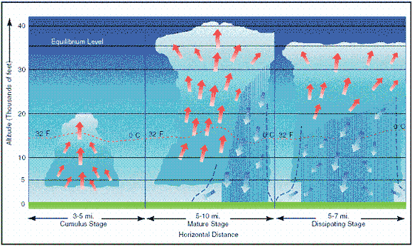
It is interesting, though, how thunderstorms are part of the atmospheric heat engine. Basically, heat is distributed unevenly by the sun over the earth. More heat comes in at the equator, but fronts and storms help move warm air north and cool air south. The ground is also the main source of heat for the atmosphere. Air does not absorb solar radiation very well, but the ground does, and the heat is conducted to the air at the ground. Mixing during the day takes some of that heat as high as 5,000 to 10,000 feet, but it is thunderstorms that are the main vertical redistributor of heat, especially on a local scale.
As air rises and clouds and rain form, heat is released in the upper atmosphere. As rain falls and evaporates, the air at lower levels is cooled. So, heat is redistributed upward in the atmosphere. Other processes play a role (ground moisture, other clouds, upper level winds). However, over the past week, the temperature at 35,000 feet has warmed about 4 degrees F at BHM, about the same as the cooling at the surface!
In a thunderstorm, the air may be 10 degrees warmer than the local air at 20,000 feet, and 20 degrees cooler than the local air at the ground. But, to see the effect on the overall atmosphere, one must look at the long term averages. So, I put together the twice-daily balloon data at Birmingham from the NWS, and here it is:
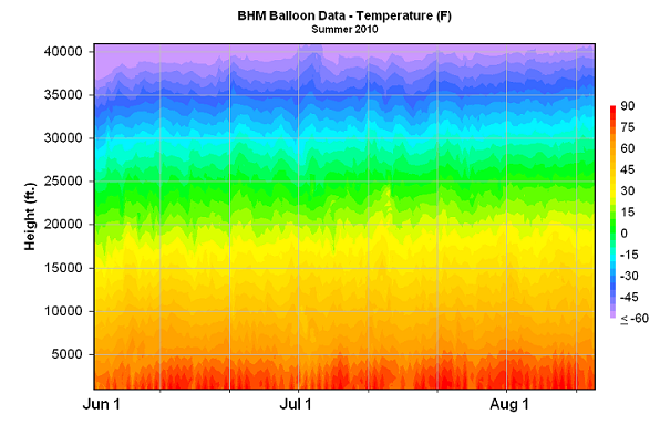
Low-level temperatures have increased a little through the summer this year, but in most years temperatures below 5,000 feet level off around July 1. Notice that, at upper levels, temperatures rise throughout the summer. Here are the temperatues at 2,000 feet and 30,000 feet, and the difference between the two (indicating stability)
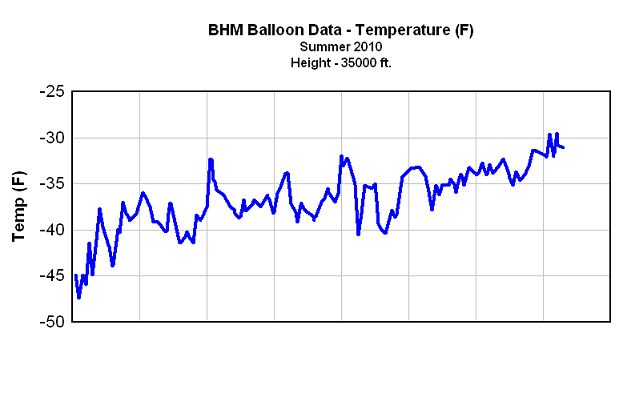
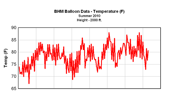
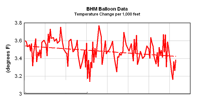
This is one reason why, in the absence of hurricanes, storms are more likely in late spring and early Summer, and start to become more scarce in August and September. The air becomes more stable. Notice how temperatures have warmed 15 degrees at 30,000 feet since June 1, but only about 5-10 at 2,000 feet. The difference between the two, a measure of instability, has slowly dropped, indicating the air is stabilizing as the summer goes on. By September, the upper levels will be warm, but the low levels will start to cool, and thunderstorms are rare (and some of the driest weather of the year occurs).



