


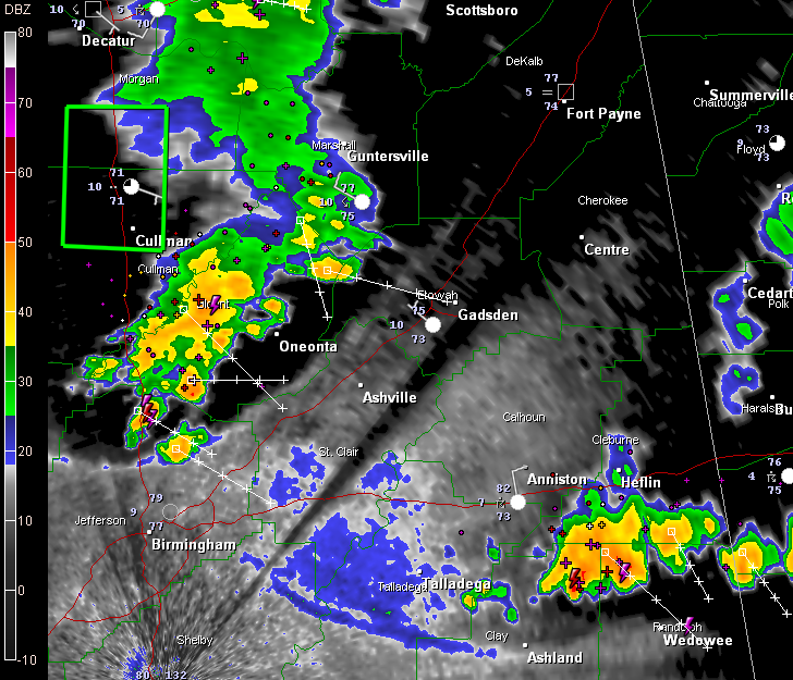
The storms over North Central Alabama just puffed out a big outflow boundary, indicating the beginning of their demise early on this Sunday morning. But they are still packing a punch for the time being, producing quite a lightning show over Blount into extreme northern Jefferson County.
This storm complex will continue to affect southern Blount, western St. Clair, northeastern Jefferson and extreme northeastern Shelby County.
In East Alabama, strong storms were pushing southeast of Anniston and Heflin now, moving toward Wedowee in Randolph County. Lots of lightning over there as well.
A flash flood warning continues for Cullman County until 1:45 a.m. 1.47 inches of rain fell at the Cullman Airport.
TO the northwest, additional storms have formed over eastern Arkansas and western Tennessee. They are pushing into northern Mississippi now. They are ahead of the main frontal system that will push into Alabama on Sunday.



