


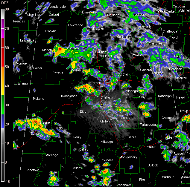
Rainfall coverage has not been as widespread as I would have liked or expected today, but some folks over the eastern half of the area have gotten some decent rains.
Brenda Varner in Springville now reporting 2.47 inches of rain with a cool 70F.
But, heavier showers and storms continue to form in the boundary between the rain cooled air to the east and warmer air in the partial sunshine to the west.
The battle ground for this activity extends from western Jefferson through Walker into eastern Marion and Winston Counties at this hour.
John Talbot reports increasing lightning and thunder from his location in Concord/Hueytown. He has 77F.
It did make it to 81F at the Birmingham Airport today.
Heavy storms were over West Alabama’s Green County. These will be lifting into Pickens County. Additional showers and storms were forming over Butler, Lowndes and Dallas Counties in South Central Alabama. These cells will lift north northwestward over the next few hours into places like Bibb County.
Showers over East Central Alabama’s Clay, Coosa and Tallapoosa Counties will lift into Shelby, Talladega, Jefferson and St. Clair Counties later.
Some heavy weather over the Georgia north of Columbus will affect extreme eastern Alabama later.



