


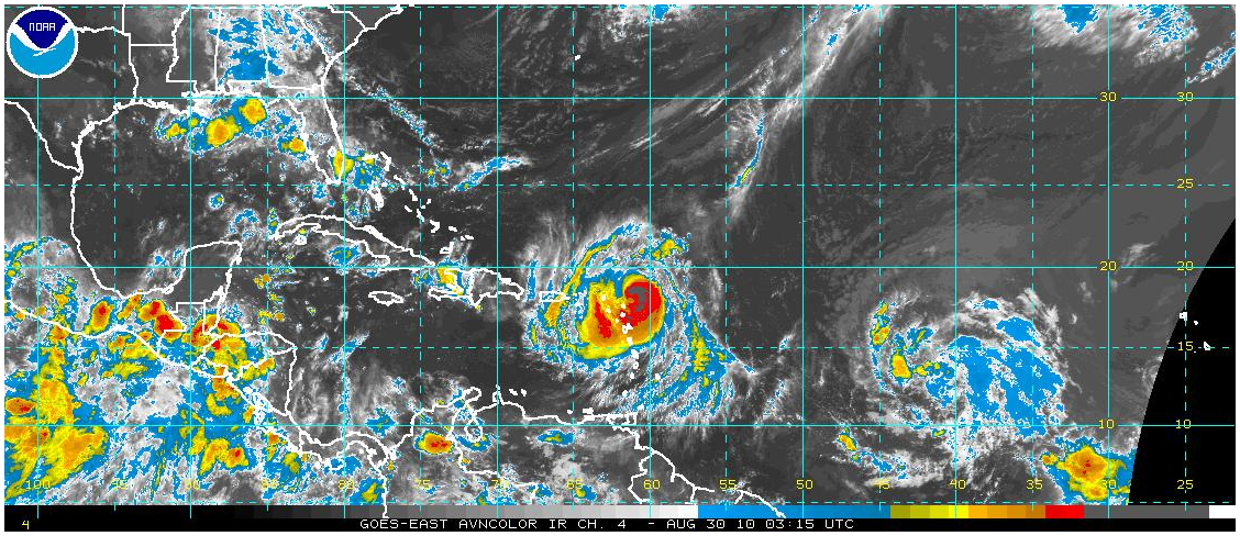
DANIELLE: Let’s get her out of the way first. The storm is weakening and slowing down as it moves over colder water about 500 miles south of Newfoundland.
HURRICANE EARL: Earl strengthened through the evening and overnight and is now approaching major hurricane status as it passes just north of St. Martin and Angulla. Air Force reconnaissance found a central pressure of 970 mb just after 10 p.m. and a max flight level wind of 96 knots, or right at 95 mph at the surface.
Earl will pass just north of the British Virgin Islands Monday afternoon with top winds over 115 mph. Strong tropical storm force winds will be felt in these locations, but hopefully not hurricane force, since they will be on the weaker western side of the storm. Still, hurricane warnings are in effect all through the northern Leewards, including the British Virgin Islands, but not the U.S. Virgin Islands, where tropical storm warnings are in effect.
Earl is going to give folks along the Mid-Atlantic Coast and in New England some sleepless nights this week. We can’t write this one off just year for sure, but the models Sunday evening were in pretty good agreement that it would miss the U.S. East Coast. Lots of aircraft missions into Earl on Monday, including the Gulfstream IV flying at high altitude to help feed the best steering current data into the models.
FIONA? The disturbance over the eastern Atlantic still has not gotten its act together, but it could at any time. The models are in agreement that this system will follow a track similar to Earl, taking it close to the islands before recurving it east of the East Coast. This one is a little close to Earl, and that is likely hurting its development right now.



