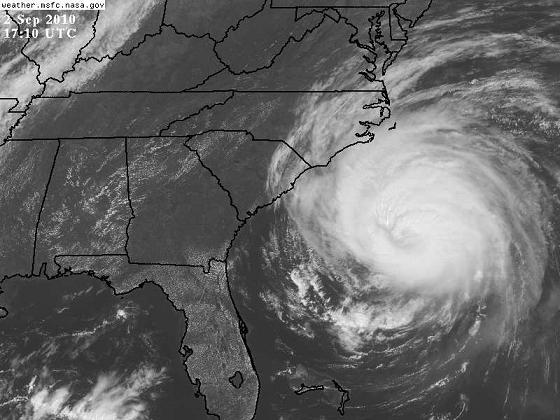
Earl has turned nearly due north this morning, as expected (great job NHC). It will be very rough in the outer banks of NC, even if there is no direct hit, since max winds are 140 mph and oneshore flow north of storm will cause storm surge and large waves. Landfall may actually occur near Cape Cod tomorrow night, but the hurricane should weaken some by then. However, the size of this hurricane will cause its effects to be felt by milliions of people, as it runs offshore of the Washington/Baltimore/Philly/NYC/Boston area, with winds up to 50 mph, coastal storm surge, and waves.

Published on: September 2, 2010 at 12:37 PM
Related Articles
June 30, 2026 at 5:41 AM
Hot Summer Weather; A Few Spotty Afternoon Storms
SUMMER HEAT: Afternoon highs will remain in the 90s across Alabama through the rest of the week, with triple digit heat index values during the afternoon hours. A “heat advisory” is in effect for the state. During the peak of … Continue reading →
READ MORE
June 22, 2026 at 5:35 AM
Strong Storms Possible Across Alabama Later Today
ACTIVE DAY: Some rain is falling across the northwest corner of Alabama early this morning… the rain is more widespread to the north over western and middle Tennessee. Showers and storms are likely over North Alabama by mid to late … Continue reading →
READ MORE
