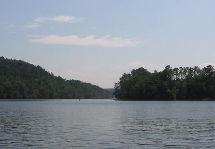
I caught this picture on Monday afternoon around 2 pm (19 UTC) looking south along the Warrior River from Bluff Creek. Notice the wavy appearance in the clouds…that is being caused by wind shear (wind increasing with height) at the cloud level (about 5,000 feet). This shear near the tops of clouds can sometimes cause parts of the cloud to be lifted in waves above the rest of the cloud top.
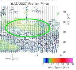
Note that the UAH MIPS wind profiler data (very sensitive radar that detects wind speed and direction) shows the shear layer near 5,000 feet around 19 UTC (2 pm), with winds increasing from 5 knots at 2,000 feet to 25 knots at 5,000 feet. The clouds in central Alabama were near 5,000 feet. Neat stuff.