


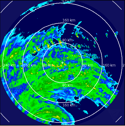
Eye of Igor clearly visible on this radar image from the Bermuda Weather Service at 7:33 a.m. CDT.
FROM THE BERMUDA WEATHER SERVICE
Hurricane Igor will be a direct hit tonight. Current tropical storm force winds will increase to hurricane force in the late afternoon. Heavy rain and showers are likely with a risk of thunder as Igor passes. Storm surge of two to five feet above normal tide levels is expected on Sunday night. Winds decrease to below hurricane force late tonight, then to below tropical storm force around noon Monday.
LATEST CONDITIONS ON BERMUDA
Windy with light rain…east wind at 32 gusting to 51 mph…temp 81…dp 75…cloudy skies.
LATEST ON IGOR
Igor is less than 200 miles SSW of Bermuda this morning, moving north at 11 mph. Like a perfectly thrown bowling ball, the hurricane’s center is expected to curve to the right today and go just to the left of the island this evening. This will put the island in the eastern eyewall most likely, the worst place to be in the storm.
Top winds are 85 mph and the central pressure is 949 millibars, so the hurricane is weaker. It should maintain its current intensity until it is past the island. It will begin to move faster during the day today and strong tropical storm force winds (58 mph or greater) should reach the island later this morning. Hurricane force winds will arrive late this afternoon and continue for 8-9 hours. The closest approach of the eye will be around 9 p.m AST.
PAY CLOSE ATTENTION TO LOCAL ADVICE
Residents of Bermuda should pay close attention to the latest advice from local officials as this hurricane passes.
GREG NORDSTROM ON BERMUDA
Chaser and Miss. St. Professor Greg Nordstrom is on Bermuda awaiting the arrival of Igor. Here is his blog about what he is experiencing on the island.



