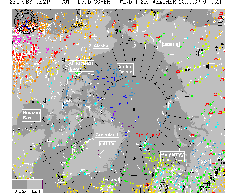
The upper air pattern is becoming a little more active this week. One upper trough should bring cool air to the midwest and increased rain chances to us by Tuesday. The GFS shows another trough late in the week, with the first significant cold front of the season reaching all the way into Alabama. If that occurs, we could see temperatures on Saturday only reaching the 70s in parts of north Alabama, with lows by Sunday morning in the 50s as far south as Birmingham! It’s still a little ways off, but something pleasant in the forecast to watch this week.
The sun angle is getting very low in the Arctic regions now, and temperatures are cooling off. In the animation below (based on observations and models since Aug 16, from NOAA/ESRL), notice how the blue area (temperatures below 41 F, 278 K) have spread out lately.

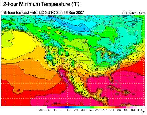
Looking at actual observations in the Arctic from 00 UTC last night, (click on thumbnail to enlarge), one can see the temperatures over the Arctic Ocean, which were near 0 C 2 or 3 weeks ago, now below -4 (25 F) in many areas. (Observations from Univ. of Cologne, Germany). (NP=North Pole). I have highlighted some interesting geographic locations in the white squares. (Great Bear Lake, for fans of the TV show about ice roads), (Polyarnyy Inlet, cold war Russian submarine base and home of “Red October” in the Tom Clancy movie), and (observation point 041150, temp -33 C (-27 F), located at an altitude of 10,000 feet on top of the snowpack/glacier in Greenland).