


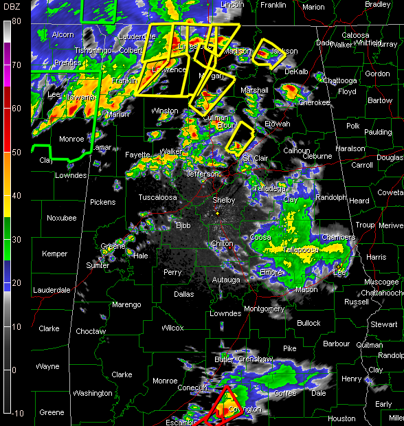
Severe thunderstorm warning continues for Blount and St. Clair Counties until 11:45 p.m. CDT.
..storm west of Springville produced 46 mph gust at the Birmingham Airport along with a complete power failure…this storm is moving toward Allgood, Oneonta and Highland Lake.
LATE REPORT: As of 11:33 p.m. St. Clair County has been cleared.
Warnings for Jefferson County have been canceled…but a late damage report…trees/power lines down on 10th Avenue South in eastern Birmingham.
Severe thunderstorm warning for northwestern Cullman and Morgan Counties in North central Alabama until midnight…severe storms in the West Point and South Vinemont areas, or just west of the City of Cullman, moving northeast toward Falkville and Eva…will eventually affect Huntsville.
Other counties in North Alabama under severe thunderstorm warning include Limestone, Madison and Jackson.
A severe thunderstorm watch continues until 4 a.m. CDT for much of North and Central Alabama.
Yes…that is a tornado warning down in South Alabama for Conecuh and Covington Counties.



