


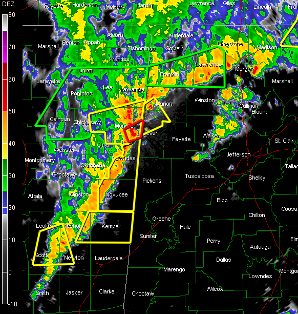
A powerful line of thunderstorms is lined up over eastern Mississippi from east of Tupelo to between Starkville and Columbus then back to between Jackson and Meridian.
The line is pushing steadily to the east.
Severe thunderstorm warnings are in effect over Northeast Mississippi for Itawamba, Chickasaw and Monroe Counties, including Okolona, Amory, Aberdeen and Smithville. This activity will affect Marion and Lamar Counties within the hour.
A tornado warning has just been issued for Monroe County MS near Columbus. Look for this storm to affect areas from Vernon to Sulligent.
A new severe thunderstorm warning was just issued for Noxubee and Lowndes Counties in Mississippi along the Alabama border.
Strong storms wil heavy rain are already over northwestern Marion and Lamar Counties generally northwest of a line from Detroit to Hamilton to Hackleburg.
Ahead of the main line, showers and thunderstorms cover parts of WInston, Cullman, Walker and northern Tuscaloosa Counties.
Strong storms continue over the Tennessee Valley, especially from Lawrence County to near Decatur and to north of Scottsboro. A severe thunderstorm warning is in effect for northern Jackson County.
A severe thunderstorm watch continues until 4 a.m. CDT for much of North and Central Alabama.
So get ready for a long night of additional warnings in Alabama, starting shortly. The main threat will be hail and damaging winds, but tornadoes are also possible from embedded cellls along the line of storms.



