


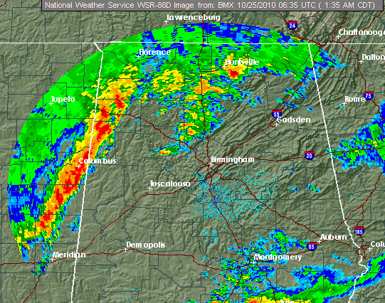
…TORNADO WATCH UNTIL 900 AM…
The main area of storms has now entered NW Alabama. The winds at 850 mb (4,000 feet) have increased to 50 mph over central Alabama, and wind shear is increasing also (winds increasing and changing direction with height). Instability is not extreme, but it is significant for this time of year, especially at night, with CAPE values of 500 to 1,000 J/kg from I-20 south (air is cooling aloft, but staying warm and humid near the ground).
The storms have formed into a mainly linear feature, which is good in that large tornadoes are more likely in lone, supercell storms. However, with wind shear and instability, a few storms along the line may rotate and produce a tornado, so we will have to watch them very closely.



