


The last thunderstorm to track through Central Alabama with this slow-to-go storm system had a punch to it for sure. Between 2:00 and 4:00 AM, a strong storm with gusty winds and some heavy rain (well over an inch in some spots) blew through Pickens, Tuscaloosa, Bibb, and Shelby Counties.
Here is a radar image of the storm as it passed over Coker where our Skywatcher Ronald Hughes reported 1.13 inches of rain in about 15 minutes.
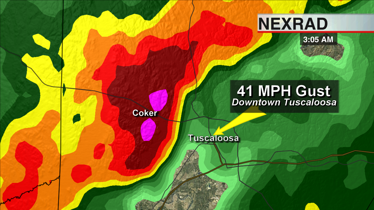
Composite image of the strong storm over Coker this morning.
The wind was also strong enough to blow part of Robin Jones’ (also of Coker) porch roof down. Thanks to Robin for letting us know about it and sending this photo:
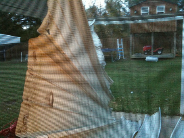
The Tuscaloosa SkyCam recorded a gust of 41 miles per hour as the storm passed. A tin roof like this usually can become unstable when the wind is above 40 mph, and this is the result. A “severe” thunderstorm has wind gusts at or above 58 miles per hour, so while this one was not technically severe, you can see that even wind gusts around 40 can peel back or blow tin roofing it off a structure.
Information like this is important when you are reporting storm damage. If someone reported this damage simply as “roof blown off of a house,” the image that comes to the mind of a meteorologist is this:

Damage from an EF-3 tornado that struck Prattville in 2008
So you can tell, it’s important to be descriptive! Otherwise we may think there is a large tornado out there when it’s just a gusty thunderstorm.
If you’re interested in becoming a Skywatcher for ABC 33/40, come see us at the BJCC during the Alabama International Auto Show on November 13th. You can learn everything from how to identify thunderstorm features to reporting what you see and know in a timely and accurate way. Here is all the information about that event called StormAlert Xtreme!
-Jason
Follow me on Twitter: @simpson3340



