


Earlier severe storms in MS really weakened as they moved into the more stable air in Alabama late last night (dewpoints low 70s there, mid 60s here). However, a few warnings have been required with the latest area of storms in NW Alabama, and in extreme south Alabama.
With moist air in place, expect scattered showers and thunderstorms, mainly of the non-severe variety, this morning. As the 850 mb winds (about 4,000 feet) transport moisture in from the SW (dewpoints in the mid 70s in Louisiana early this morning), a few storms may become severe this afternoon over Alabama. However, the best chance for widespread severe weather will be to our north, where low-level wind fields will be stronger.
Later this evening, a squall line will develop to our west as the main upper-level (500 mb) system approaches. This line should move through between midnight and 6 am. The main threat with this line as it moves through overnight will be damaging winds, but isolated tornadoes are possible given the wind shear.
There are several variables that come into play here. Models show a hint that the showers may let up for a while this afternoon, allowing the sun to come out for a while. If this happens, the atmosphere will destabilize quickly, making the storm potential a little bit higher tonight. Any storms that form out ahead of the main line this evening will have a higher tornado threat. And, an area of storms near the Gulf Coast this morning, if it continues throughout the day, could take some of the energy from storms in north and central Alabama.
Bottom line…scattered storms today with the threat for severe weather slowly increasing by afternoon and evening. Squall line overnight. Isolated tornadoes possible over Alabama during the next 24 hours, but main tornado threat way to our north.
Below are some model analyses for 7 am today through 7 am Friday, rendered using the NCAR IDV system, similar to NWS graphics.
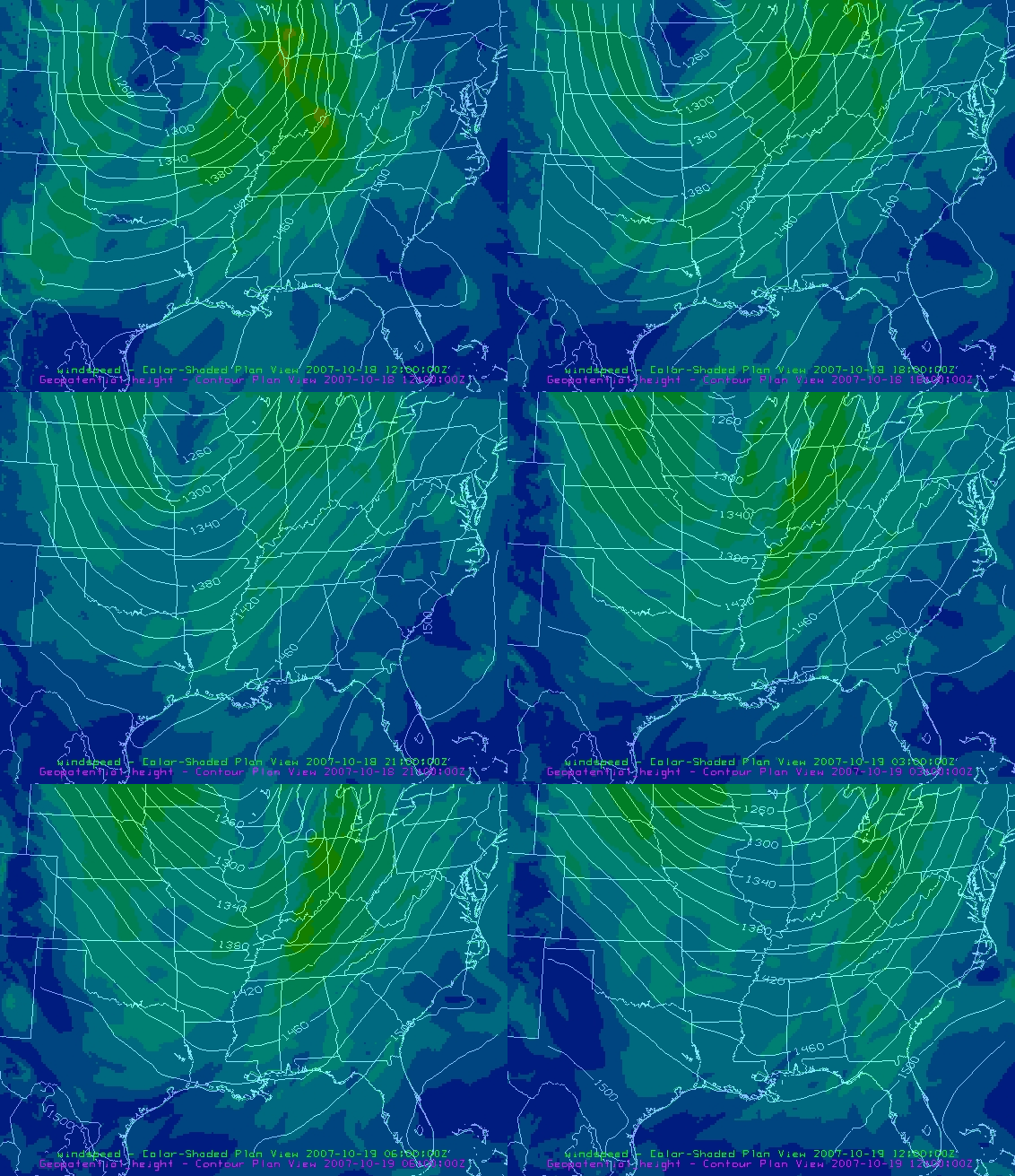
850 mb heights (contours), wind speeds (shaded)
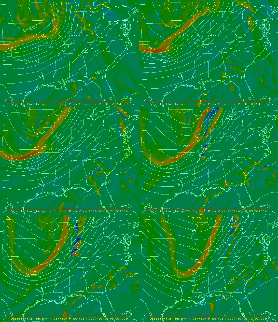
500 mb heights (contours), vorticity (shaded).
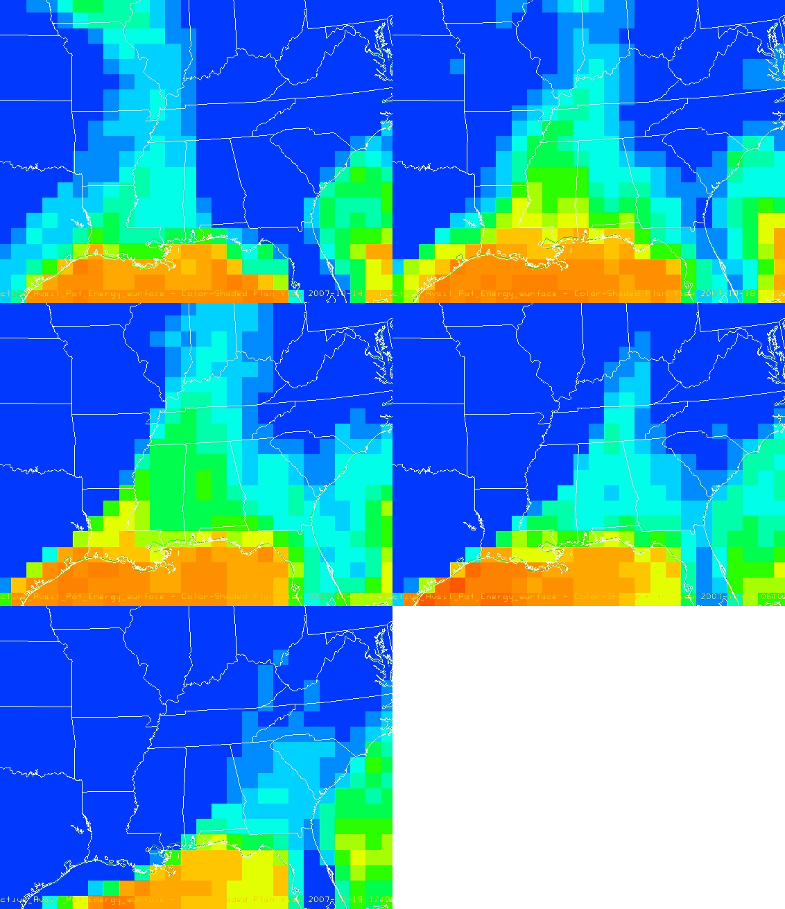
CAPE (a measure of instability)
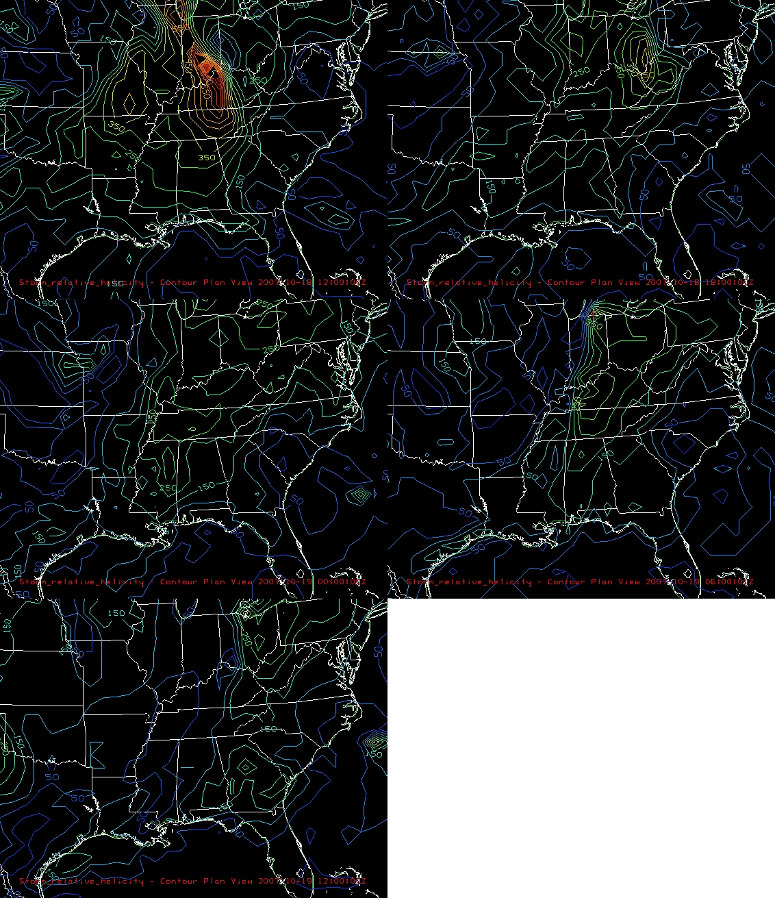
Storm-relative helicity (a measure of wind shear for storm rotation)



