


The National Weather Service in Birmingham has expanded and extended the Freezing Rain Advisory until 4 PM for most of Central Alabama including Birmingham, Tuscaloosa, Anniston, and Gadsden.
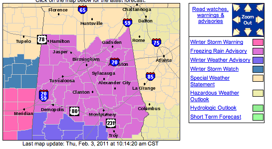
Freezing Rain Advisory Until 4 PM for Central Alabama
Roads are already becoming icy over southern Mississippi, and precipitation (a wintry mix) is still developing and getting heavier south of Jackson and Meridian. It’s moving northeast toward Central Alabama, but a lot of it will fall as snow and sleet which may reduce the “glaze” effect of the freezing rain.
Due to the showery nature of the mixture, icing will be very spotty. Trying to give a start time for precipitation is not possible; it could start where you are at almost any time, and with temperatures in the 20s and 30s, light accumulations of ice are possible on some highways (especially bridges). So, to put it simply, icy spots will start developing within the next few hours around Central Alabama. It will not completely “ice over,” but use caution as you travel this afternoon and evening.
The main event still comes tonight as a strong surface low develops ahead of an upper-air disturbance to our west. As much as 1/4 to 1/2″ of ice is possible over the northern and western counties of Alabama tonight through mid-morning on Friday. Here is a look at the expectations for the “main event” through tonight & tomorrow.
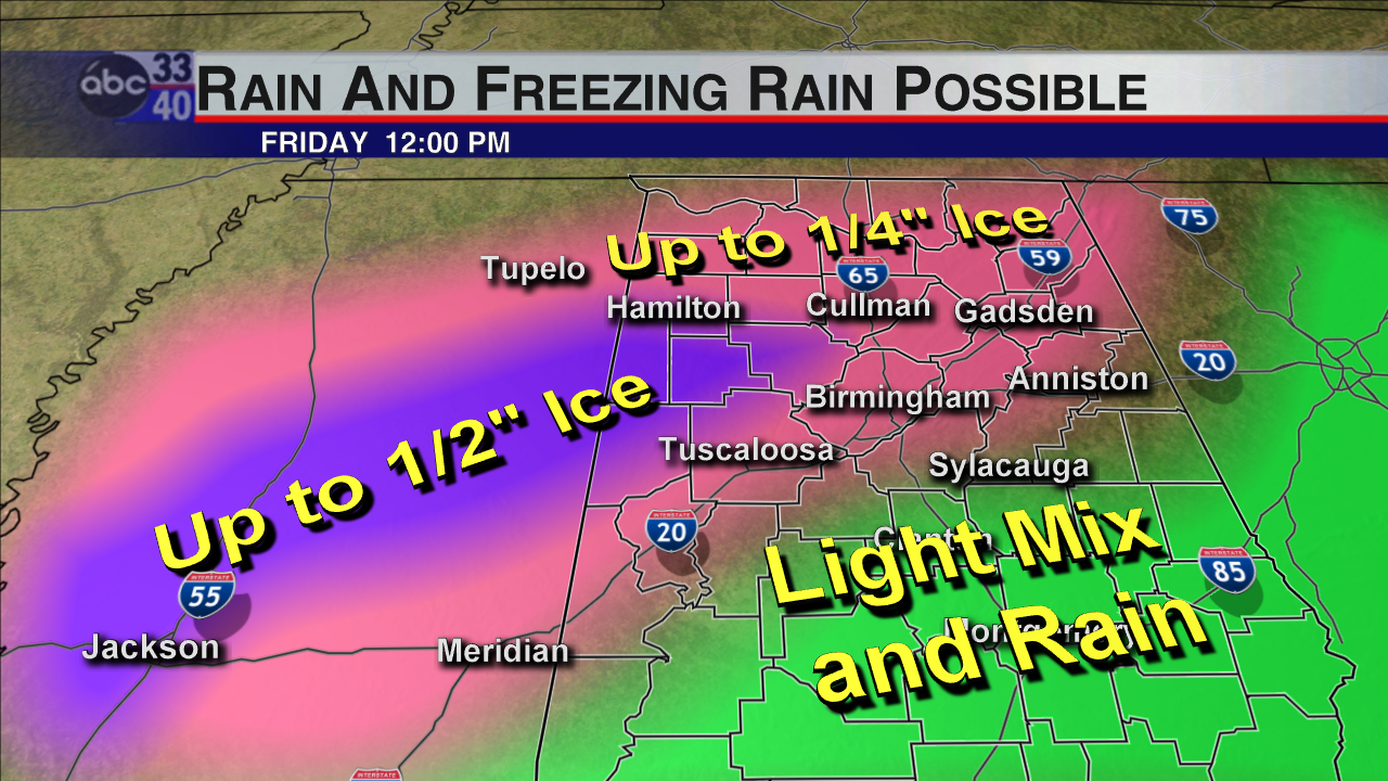
Approximate Areas of Icing Tonight & Friday Morning (some adjustments will be necessary)
Adjustments will be needed to this map, and even some counties are in the “Light Mix and Rain” area could still get a light glaze early tomorrow morning. The worst of this will be northwest of Birmingham and Tuscaloosa; Mississippi will take the hardest hit with around 1/2″ of freezing rain and sleet.
-Jason
Follow me on Twitter: @simpson3340



