


The weather has really changed over the past few days. We’ve finally gotten some much-needed rainfall, and cool air has come in. Take a look at a graph of temperatures at the Birmingham airport, going back to 8 am Sunday. This graph was constructed using hourly observations up through 2 pm today, then GFS forecast temperatures through next Tuesday morning.
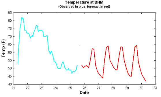
It reached 82 degrees on Sunday afternoon, 77 on Monday, then temperatures fell nearly all day Tuesday, from 70 early in the morning to 50 by late evening. It never made it above 60 yesterday, and it probably won’t today either. Has your heat run yet?
The GFS forecast for the next 4 days at least shows temperatures rising in the day and falling at night, with sunshine returning. But, lows will be in the 40s, and highs will struggle to reach 70.
After a return to zonal (west-to-east) flow late next week, which typically means temperatures near normal, the GFS predicts another storm system with cold air by next weekend (Nov. 3-4). We’ll see.




