The cold front is on its way. It is from near Louisville to Little Rock now, and will come through BHM early tomorrow morning.
As James points out, this is the coldest air so far this season. Even with sunshine, temperatures won’t make it out of the 50s tomorrow afternoon, and gusty winds will produce wind chills in the 40s at times. Then, temperatures will drop to near freezing the next two nights. Wednesday night could be the coldest. With the wind dying off, some valleys may reach well into the 20s.
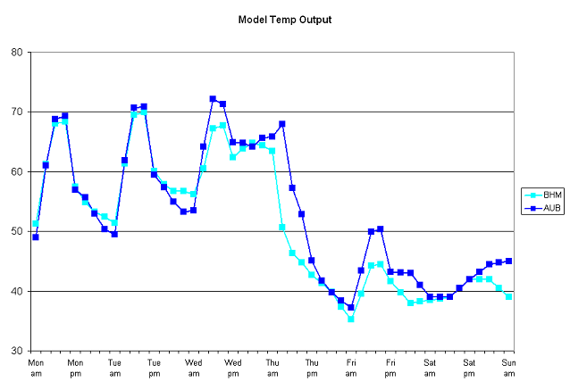
Below is a graph of temperature at BHM from 6 pm today through 6 am Saturday morning, from the GFS model. Also, an animation of a cross-section of temperature from roughly Bowling Green, KY to Montgomery, and up to about 15,000 feet, at 3-hour intervals from 6 pm today through 3 pm Thursday. You can really see the cold air moving in from the north (the numbers at the bottom are latitude, so north is to the left).