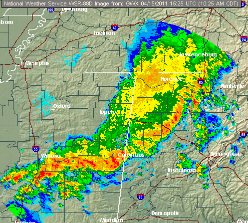
Line of storms moving through NW Alabama is in fairly stable air for now, so mainly non-severe. However, the part from about Fayette on west into central MS is in an area of higher moisture and instability. These storms will have to be watched very closely, in addition to any that form south of that region.
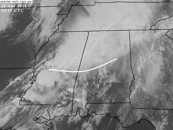
Notice there is a cloudy/sunny line from Talladega to Meridian. This will allow temperatures south of that line to warm up faster, creating a boundary that could enhance storm rotation. A tornado has been reported along the boundary in central MS, and a supercell has formed west of Jackson, MS also.
The air will slowly destabilize over Alabama today from west to east. Most of the tornado threat should stay south of the cloudy area, but if the sun starts breaking through the clouds and it rises into the 70s in BHM and Cullman, tornadoes will be more likely there, too. The main tornado threat is from Tuscaloosa to Clanton and south, at least for the next few hours.
The dryline/front is still way back near Memphis, so additional storms will continue to form this afternoon and evening, and the tornado threat could move farther north by then as there is more time for moisture to move into places like BHM, ANB, GAD. We will also see large hail and damaging winds, and possibly flooding.
This is a very complex situation, and we will not be in the clear until the dryline moves through tonight after midnight. Please have a source of weather information handy. I’m headed down I-20/59 chasing.