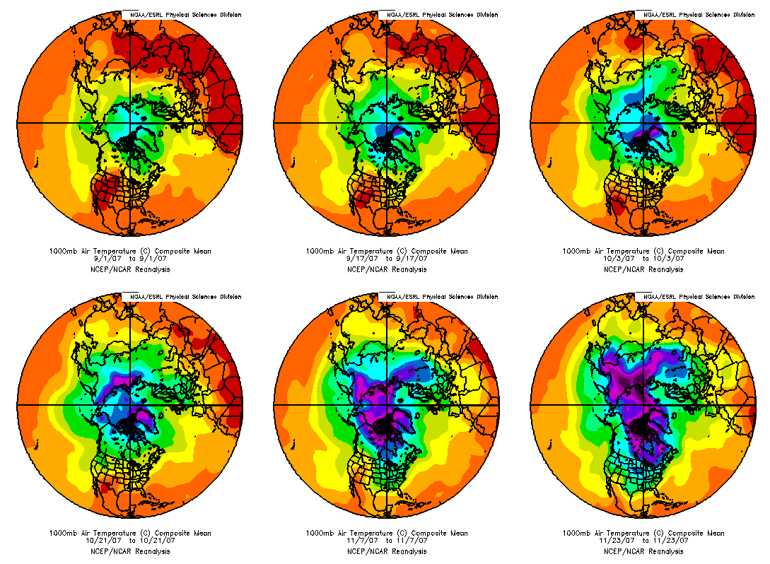
It’s getting late into the fall now. The leaves are mainly brown in Alabama, and the days are short. It’s cold outside now, and there’s plenty of cold air to go around. Let’s take a look at how the Northern Hemisphere has cooled the past few months, and the very cold air building not too far to our north.
First of all, this loop was constructed using NCEP reanalysis data. It shows daily temps (average of high and low) from Sep 1 through Nov 24. Notice how the air just keeps getting colder in the Arctic, and spreading out. Cold air is heavier than warm air, so its natural tendency is to spread out southward anyway, much like when you pour water on a table (water is heavier than air). You can see ebbs and flows, caused by weather systems, with occasional cold fronts bringing cold air into the U.S. Neat graphic!

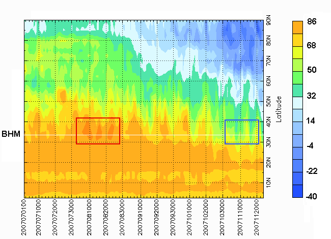
Below is a time-latitude chart of temperature at 85 W (the longitude that runs through east Alabama, roughly), since July 1. The dates run left to right. Notice the heat wave at latitude 30-35 degrees in August (BHM is at about 34 degrees N), and the cold fronts coming southward in November.
A very large mass of cold air is building over Canada, and will start to move into the northern U.S. next week. Take a look at GFS model temperatures for next Tuesday morning below.
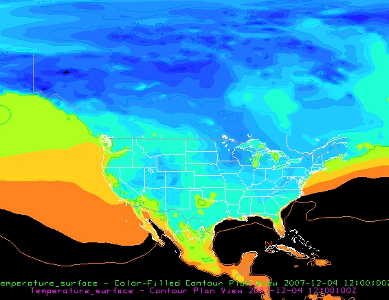
The area of medium blue in SE Minnesota and western Wisconsin is below zero, with 20s into NE Alabama. The huge area of medium and dark blue in Canada is below zero, some of it as low as -30!