


The Storm Prediction Center placed parts of Central and East Alabama in a *SLIGHT* Risk for some strong and severe storms this afternoon. All “slight risks” are not created equally, though! Today’s risk has nothing to do with tornadoes or long-lived violent storms; instead, it is an outlook for an area where a few, short-lived strong or severe storms are possible.
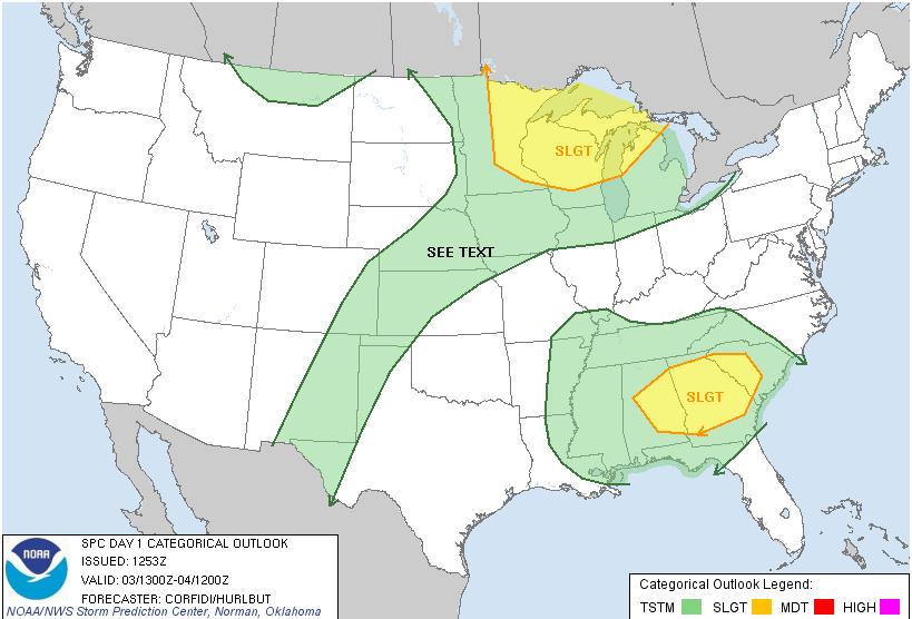
A weak disturbance coming down the eastern side of the oppressive heat ridge will be able to tap into a lot of hot, humid air at the surface and get some storms going. They will still be pretty spotty in nature, so the ability to pinpoint a storm for a particular city even an hour in advance is almost impossible unless the storms develop in close proximity to each other and help initiate a linear complex or some larger clusters of storms. That is possible, but most of this will be very spotty, isolated convection in Alabama.
A quick “pulse” storm in Tuscaloosa County on Thursday was enough to create some coin-sized hail and wind gusts over 50 MPH near Greensboro Avenue in Tuscaloosa. Some lawn furniture was blown around and a few trees blew over, but it happened in a very small, localized area.
Storms like this can blow up and collapse very quickly, and there may not be enough time for issuing a severe thunderstorm warning before the storm has done it’s thing and weakened (pulse storms stay at peak intensity for only a few minutes). The bottom line here is to just stay aware when the sky gets dark on a hot, summer day. These storms do not have the power of Springtime dynamics, but they can still get rough for a few minutes!
-Jason
Follow me on Twitter: @simpson3340
Facebook: Jason Michael Simpson



