


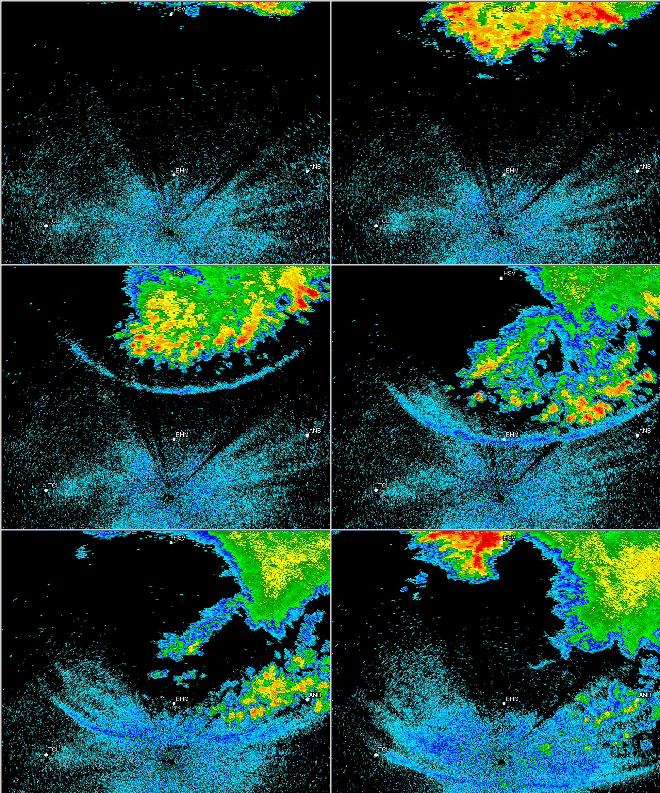
After strong storms developed right around sunset in Tennessee, then moved south into north Alabama, producing wind gusts up to 69 mph in Huntsville, they began to dissipate as they moved further south.
Here over central Alabama, there was a layer of cooler, more moist air near the surface, as is common on nights with a clear sky. This air is more dense and sits near the ground, like a shallow layer of water. Sometimes, when the cold air outflow from a thunderstorm punches that low-level cooler air, it initiates a wave on the cooler air, just like you pushed shallow water with a shovel.
The fine blue line that comes south toward BHM and TCL, in this case, is not a cold outflow boundary, but a wave, and it eventually breaks up into multiple waves (look between BHM and TCL late in the loop).
One way we can show it was a wave is using surface data. Here are the pressure, and then temperature and dewpoint plots, from Parrish, AL from last night (high resolution, every 10 minutes).
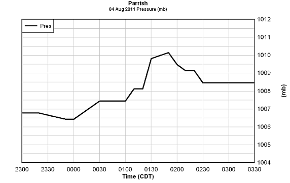
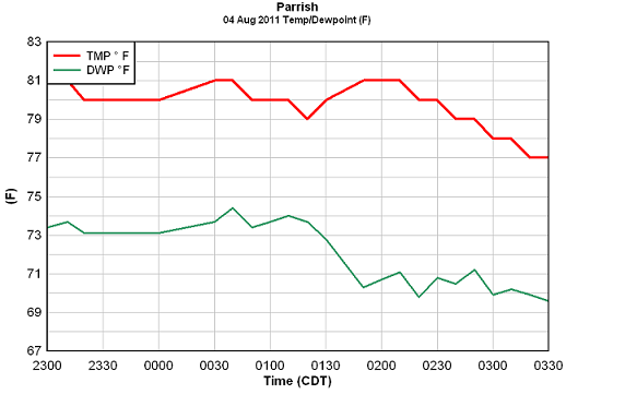
The pressure rises 2 millibars (about 0.06″) between 120 and 150 am. If this were associated with a thunderstorm outflow, the temperature would drop. But, during that same time frame, the temperature warms from 79 to 81, and the dewpoint drops from 74 to 71! This is because the wave is mixing up that cool layer of air at the surface (winds blew about 25 mph as this wave moved through), and brought some of the warmer, drier air from above the surface down to the ground.



