


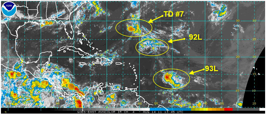
Click to enlarge
Franklin went bye-bye last night, becoming non-tropical to the northeast of Bermuda.
Tropical Depression Seven is expected to pass just east of Bermuda early Monday. Tropical storm warnings have been issued for the island. TD #7 is expected to become a tropical storm since it is in low wind shear, but it is surrounded by very dry air, which is a limiting factor. When and if it does become a tropical storm, it will be named Gert.
The system northeast of the northern Leeward Islands (92L) still is not very organized and fighting dry air as well, but still has a chance to become a tropical depression in the next 48 hours. It could threaten Bermuda in a couple of days as well.
We continue to monitor a tropical wave that is 600 miles east of the northern Windward Islands. It was 93L, but the NHC has actually stopped assigning it a disturbance number. Convection has slowly been increasing with this system and it looks a little better to me in terms of organization this morning. The models have backed off on developing this system I the short term, but I think it will have to be watched as it moves into the Caribbean and it could be a factor by next weekend over the western Caribbean or southern Gulf of Mexico.


