


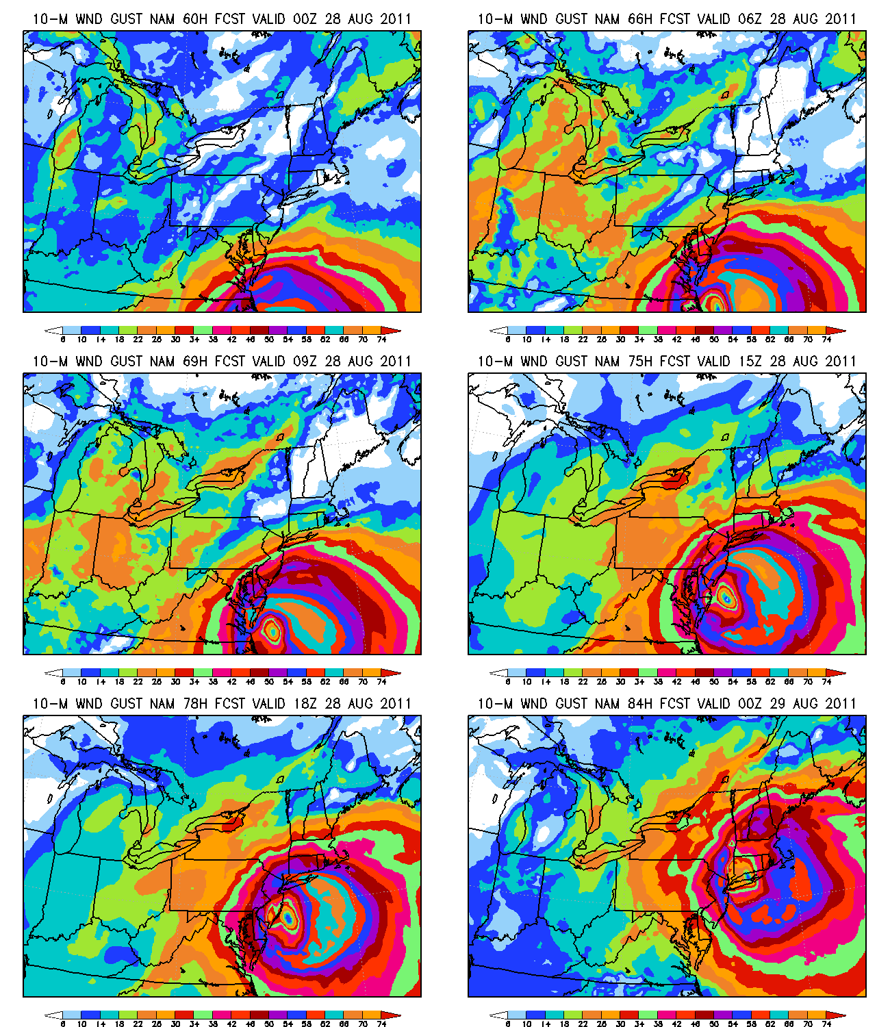
Above is the NAM high-resolution forecast for maximum surface wind gusts (in knots) every 3 hours as Irene moves up the eastern seaboard. Based on this model forecast (it could be off a bit, especially as time gets later, and based on NHC wind radii, this model may be a bit conservative), here are some maximum wind gust predictions at a few locations:
Norfolk/Newport/Williamsburg, VA: 56 knots
Richmond, VA: 38 knots
Washington, DC: 42 knots
Baltimore, MD: 50 knots
Dover, DE: 58 knots
Philadelphia, PA: 55 knots
Atlantic City, NJ: 65 knots
New York, NY (Manhattan): 60 knots
Long Island, NY (Hamptons): 70 knots
Boston, MA: 55 knots
Again, these are extrapolations from a single model output, and should not be used for any official purposes. They are simply rough estimates to give you an idea of what this storm will be like for millions of people that are not generally used to hurricanes.
The other problem could be storm surge. Even though the hurricane will be weakening (NHC has it down to sustained winds of 85 knots/95 mph by the time it gets to Delaware, and 55 knots sustained at the US/Canada border), that could still mean hurricane storm surges as far north as New York City. Mayor Bloomberg is preparing with boats to evacuate people in a worst-case scenario.
There is still some spread in the model guidance. If the storm goes a little left of the NHC track and comes inland and stays inland earlier, it would weaken faster, meaning a worse storm in NC and SE VA, but less in MD, DE, NJ, NY, and MA. If it completely misses the outer banks of NC and makes no landfall, it could stay a little stronger, although it will be moving over cooler water.
This hurricane will not impact Alabama. But, this could be a big deal given the areas it is moving towards, maybe the biggest in 5 years or more.
On another note, I will be teaching a 4-week class on Basic Meteorology (targeted to the general public) this fall. For more details, see https://www.alabamawx.com/?p=52101.


