


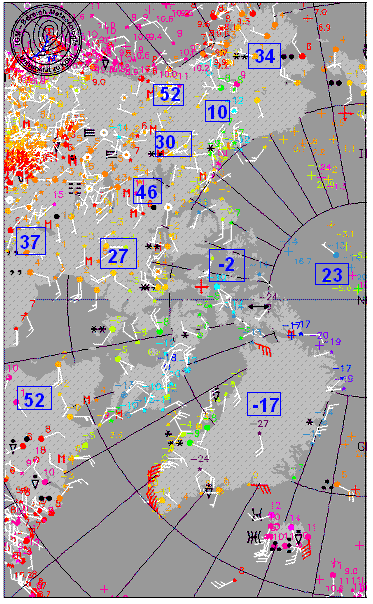
The days are getting shorter here, but they are really getting shorter in the Arctic regions of Alaska and northern Canada. At Fairbanks, they were still getting 14 hrs and 38 min of daylight each day on Sep 1. Today, they get 9 hrs 58 min, and are losing 6 min per day. The sun angle up there is also getting very low in the sky, so their noon now looks like our late afternoon. Consequently, it is really starting to cool down over the Arctic regions. The map above shows the western hemisphere side of the Arctic, with temperatures in C. I converted several of the temperatures in some places to Fahrenheit (the blue boxed numbers).
The Arctic Ocean, where temperatures sit near 32 all summer as ice melting uses a lot of heat, has started to cool, with temperatures in the 20s now. Over land, it has cooled faster of course, with temperatures in the teens and 20s over parts of Alaska, and 30s as far south as central Canada today.
The cold air will continue to build up there in coming weeks, and the models seem to agree now that a piece of the cold air will move south next week, likely bringing us our coolest air of the season so far. Below is a loop of temperatures over the next week (starting today) from the GFS model. The European model is not quite as aggressive with the cold air, but still pushes cold air into the SE US.
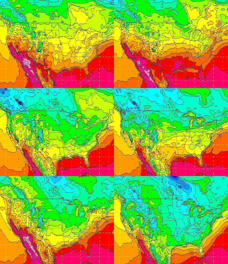

The cold front comes through on Tuesday, and temperatures may drop into the 40s Tuesday night, and highs may struggle to reach 60 over north Alabama Wednesday and Thursday. Thursday morning lows could reach the 30s in some locations, but it’s too early to know that right now. Either way, unless the models drastically change, many of us will have to turn on some heat by Wednesday night, with cool daytime temps and cold overnight temps!



