


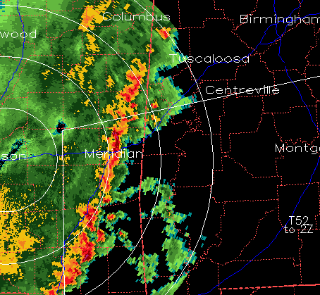
The storm from eastern Mississippi still shows a hook echo in reflectivity, indicative of rotation. It is now in Pickens County, near Reform and Palmetto, moving NE.
There are other storms we need to watch farther south, from Columbus, MS to Meridian, MS. We have recieved reports of damage and in the Jackson, MS area. The main focus for severe weather this afternoon in Alabama may be in the southwest part of the state, south of I-20 and west if I-65, where the air is more unstable.
However, even in north and central Alabama, the air is unstable enough to support severe storms (as we see with the storm on radar coming into Pickens county). Take a look at UAH MPR sounding from 144 pm.

It is not extremely warm or humid at the surface, but the temperature aloft drops very quickly, below zero at 15,000 to 20,000 feet. So, the air is somewhat unstable, especially for drier air like this. And, wind shear is relatively high, which sometimes helps storms in weak instability environments to grow. A few storms may make it farther north than the tornado watch area.
How far north or east these storms will make it is unclear. But, people in the Tuscaloosa and Birmingham areas need to keep weather information handy this afternoon.



