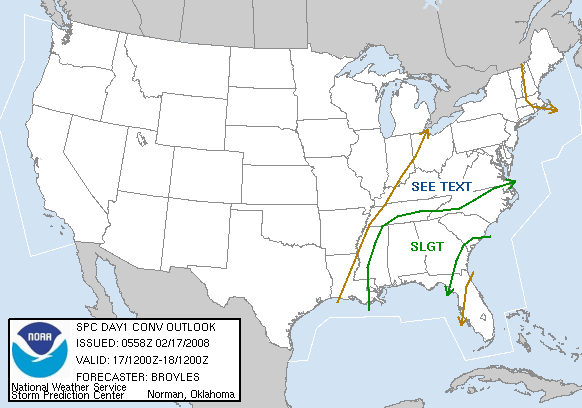
SPC has placed all of Alabama in a slight risk for severe storms for today.
The models have come in more aggressive for severe weather across Alabama. The NAM paints a more intense event, but the GFS also shows a threat for severe weather. Right now, the GFS looks a little more reasonable.
A cold front will approach Alabama today, and strong winds will bring Gulf moisture in quickly from the SW. Dewpoints will rise to near 60 as far north as Cullman, but with cool surface temperatures instability will be somewhat limited. The highest instability will be from BHM south, where CAPES will likely be 500-1000 J/kg. The wind shear will be very strong again, with 0-1 km helicity 200-300 m2/s2. So, storms will have the potential to rotate. Surface winds out ahead of the storms will gust up to 35 or 40 mph at times, possibly causing some minor damage away from thunderstorms.
It looks like a squall line, currently from eastern Arkansas into eastern Louisiana, will move into west Alabama by 7-8 am. This line will move across parts of the state this morning, with the main threat being damaging winds, but isolated tornadoes are possible. Any storms that form out ahead of the main line will be more dangerous. The line may approach BHM by 11 am.
A tough question is whether or not additional storms will form later this afternoon, behind the main line, or if the squall line will slow down or fall apart at its southern end, south of I-20, allowing storms to develop there later. Either of these scenarios would bring a higher risk for tornadoes this afternoon, but are difficult to forecast now.
Brian will have a complete update on the blog by 600 am or so. This is a day to keep an eye on the weather. Groups today in places of worship should have someone assigned to keep up with the weather at all times using a weather radio or TV.