


I had a wonderful time at the American Meteorological Society student conference this morning in New Orleans… it was extremely refreshing to see so many college students with a passion for science, and specifically meteorology. There is so much to learn about the earth’s atmosphere, and I know they will take it to the next level.
BACK IN THE SADDLE: I worked the morning severe weather event via social media (Twitter, Facebook, Google Plus) from Louisiana while Bill Murray, Brian Peters, and Ashley Brand handled things on this end. Thankfully there were no major issues and no tornado warnings in Alabama. But, now we turn our attention to tomorrow night and Monday morning…
Below is the day two convective outlook from the Storm Prediction Center…
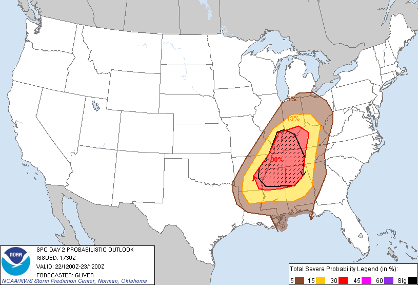
Most are expecting that 30 percent area (hatched) to be upgraded to a moderate risk when the new day one outlook comes out at midnight.
Below is the projected 500 mb look at midnight CST tomorrow night (around 18,000 feet)…
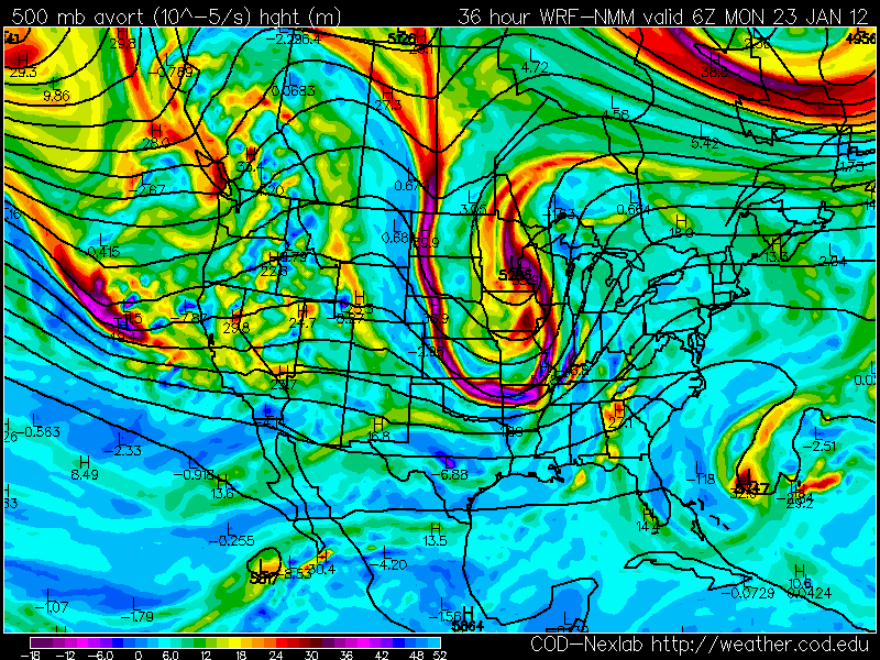
Note the deep trough just west of Alabama, which is in the process of going “negative tilt”, which enhances diffluence and lift ahead of it.
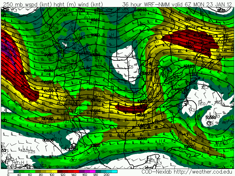
And, at jet stream level (250 mb, or about 25,000 feet)… note the highly diffluent flow, and 125+ jet max…
And, below is the SREF showing the chance of the STP (significant tornado parameter) going over 1 tomorrow night at 9:00…
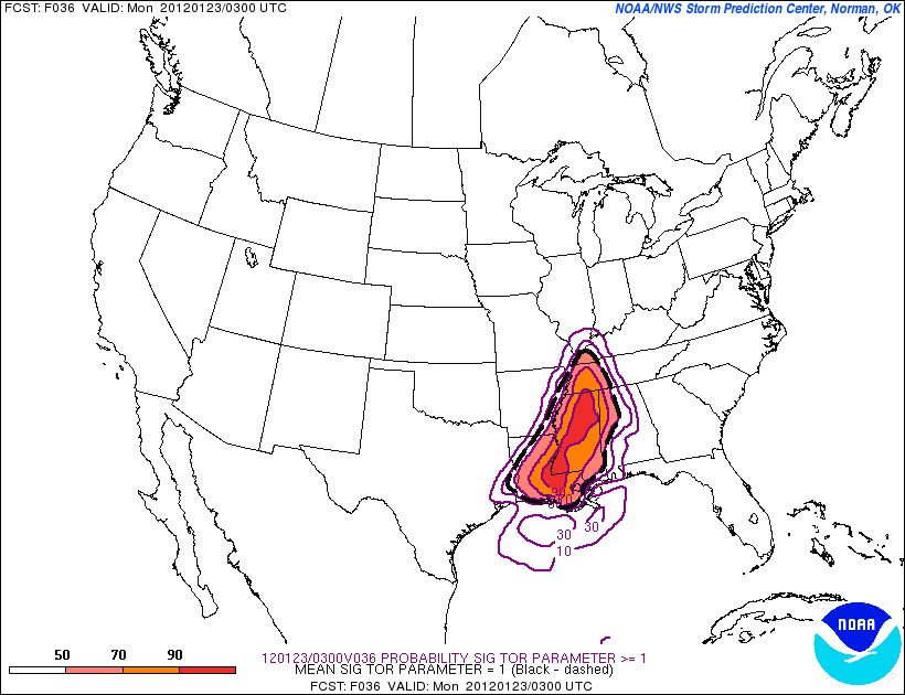
At that time the highest STP values, most likely, will still be a little west of Alabama.
BY THE WAY: I have no earthly idea what “stormcon” means… this is something that is proprietary the Weather Channel uses. If every TV station and If every TV station had their own “torcon”, “stormcon”, “deathcon”, or whatever, it will be total mass confusion. Lets ALL use the STP.
WHAT DOES IT ALL MEAN: There is excellent dynamic support for severe thunderstorms across North Alabama late tomorrow night into early Monday morning. As usual, the limiting factor will be the lack of instability. But, this event will potentially feature CAPE (convective available potential energy) values over 1,000 j/kg, which is higher than recent events.
During the afternoon, thunderstorms should break out over parts of Arkansas, Mississippi, and West Tennessee. These storms will, most likely, initially be cellular and they will have the potential for a few tornadoes. These storms should push into Alabama tomorrow night, and all of the activity should roll over into a long squall line after midnight, with potential for damaging straight line winds.
TIMING: Storms could impact West Alabama in the 8:00 p.m. to 12:00 midnight time frame, but the best model consensus suggests the main severe weather threat here will come from about midnight to 6:00 a.m. The best chance of tornadoes will be over West and Northwest Alabama as the event begins; but we can’t totally rule out an isolated tornado over East Alabama.
UNDERSTAND: Even with such impressive dynamics, this is still nothing like the April 27, 2011 generational outbreak.
The point of this post is to take this opportunity to underscore the threat for a rapidly-evolving and high-impact severe thunderstorm event tomorrow night. Brian Peters will have a detailed discussion and fresh Weather Xtreme video early tomorrow.
BE SURE you don’t rely on an outdoor warning siren to get warnings tomorrow night. Have a NOAA Weather Radio properly programmed. And, use these options…
*iMap WeatherRadio App: This is available now for iPhone only, but an Android version will be released soon. The GPS chip in your phone knows where you are, and if you are in a polygon warning, you get it. If you are not in the polygon, you won’t be alarmed. Also, you can program fixed locations.
*James Spann Facebook Page: All Alabama warnings are posted there automatically. You can subscribe via SMS if you like (text message to your phone).
@ewarn on Twitter: All Alabama warnings are posted on this account within seconds of the time they are issued.
Should we go into tornado coverage tomorrow night, you can watch our live stream on the iMap WeatherRadio app, any of the ABC 33/40 mobile apps, or through abc3340.com or uStream.com
And, of course, this blog is the main form of communicating information to you when we are not on TV. Stay tuned…



