


As expected, the Storm Prediction Center has upgraded the severe weather risk to “moderate” later today and tonight for parts of Northwest Alabama, North Mississippi, West Tennessee, and East Arkansas.
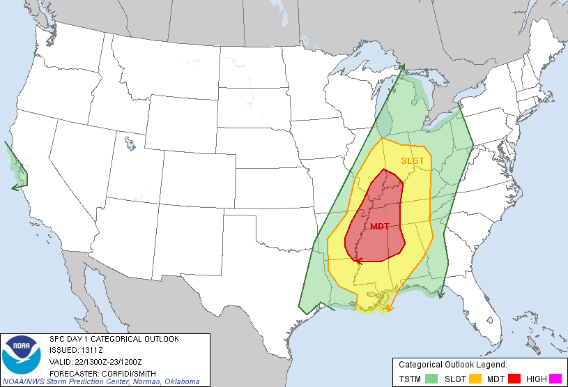
The highest tornado probabilities are in that area… there is a 15 percent chance of a tornado within 25 miles of any given point in the red zone below…
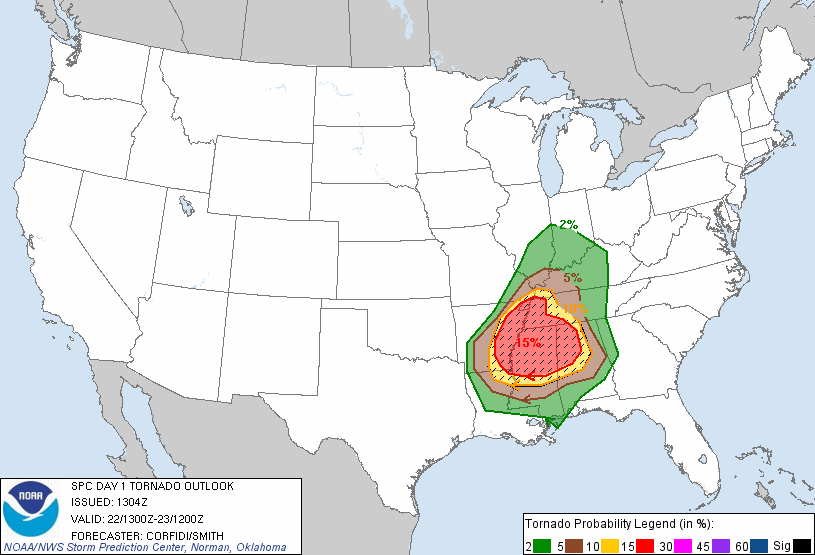
Within the moderate risk, there is a chance of a couple of long track tornadoes. SPC did shift the moderate risk into North Alabama on the latest update.
HERE IN ALABAMA: As you can see, the higher tornado probabilities (15 percent) are over the northwest counties of the state. The risk drops off a good bit over East Alabama.
There are many bad rumors and lots of misinformation going on with this event. This is NOTHING like April 27 for our state. That was a generational outbreak. While the dynamics for tonight’s event are very impressive, thermodynamics (instability) are somewhat marginal.
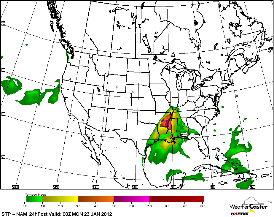
During the afternoon, thunderstorms should break out over parts of Arkansas, Mississippi, and West Tennessee. These storms will, most likely, initially be cellular and they will have the potential for a few tornadoes. Maybe a few violent, long track ones. See the forecast STP (significant tornado parameter) for 6:00 this evening…
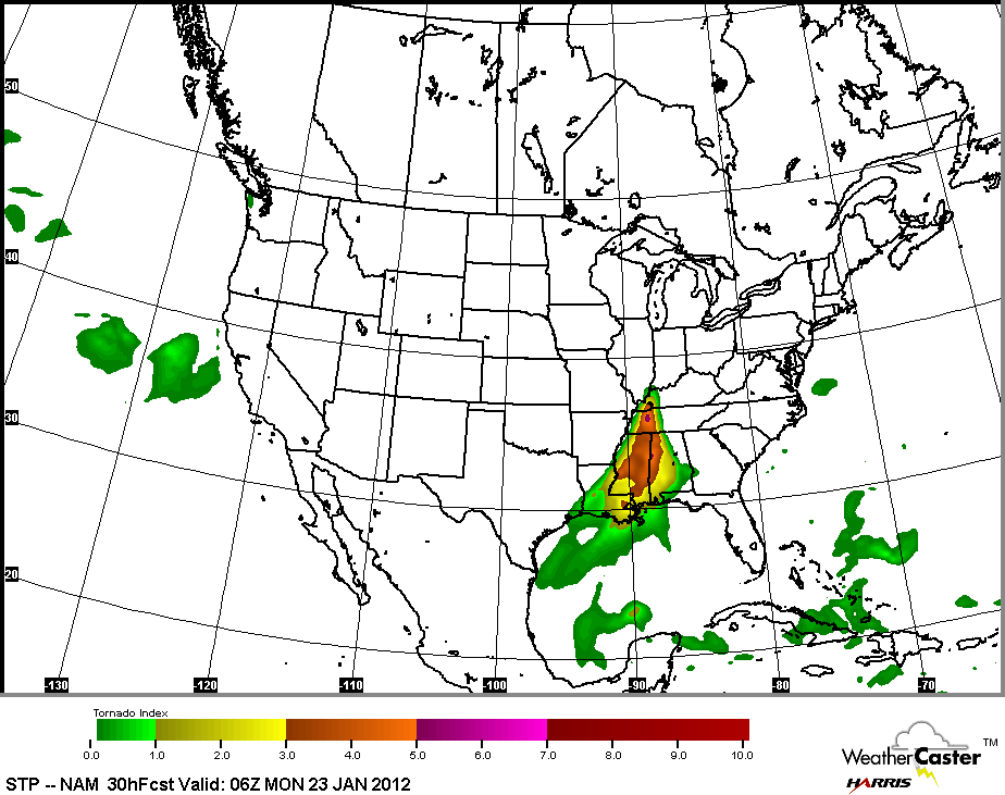
By midnight, here is the forecast STP:
Below is a graphic showing the moderate risk over Alabama… the counties within the blue hatched area are in that enhanced risk:
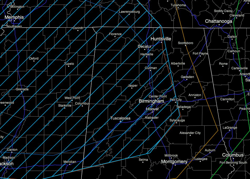
TIMING: Severe storms could impact Northwest Alabama in the 8:00 p.m. to 12:00 midnight time frame, but the best model consensus suggests the main severe weather threat here will come from about midnight to 6:00 a.m. Aside from the tornado threat for Northwest Alabama, it is my opinion that the greatest risk will come after midnight when the storms roll over into a long squall line. This line of storms will have a good chance of producing significant straight line wind damage. The straight line wind damage potential along the line is really greater than the tornado threat for most of the state. And, with this coming during the pre-dawn hours tomorrow, you have to be in a position to hear warnings. Winds along the line of storms after midnight could easily exceed 50 mph across a wide area.
The point of this post is to take this opportunity to underscore the threat for a rapidly-evolving and high-impact severe thunderstorm event tonight. Brian Peters will have a detailed discussion and fresh Weather Xtreme video shortly.
CALL TO ACTION: No NOT rely on an outdoor warning siren to get warnings tonight. Have a NOAA Weather Radio properly programmed. And, use these options…
*iMap WeatherRadio App: This is available now for iPhone only, but an Android version will be released soon. The GPS chip in your phone knows where you are, and if you are in a polygon warning, you get it. If you are not in the polygon, you won’t be alarmed. Also, you can program fixed locations.
*James Spann Facebook Page: All Alabama warnings are posted there automatically. You can subscribe via SMS if you like (text message to your phone).
@ewarn on Twitter: All Alabama warnings are posted on this account within seconds of the time they are issued.
Should we go into tornado coverage tonight, you can watch our live stream on the iMap WeatherRadio app, any of the ABC 33/40 mobile apps, or through abc3340.com or uStream.com
And, of course, this blog is the main form of communicating information to you when we are not on TV. Stay tuned for updates and notes throughout the day.



