


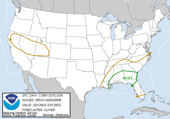
SPC has placed much of central and south Alabama in a slight risk for severe storms for today.
A low pressure area, currently in central Louisiana, will move northeastward this morning, through Mississippi and into Tennessee by noon. As the low moves NE, it will bring a warm front northward also. Out ahead of this warm front, more heavy rain will move across central Alabama early this morning, and there may be some lightning and thunder too.
Some stronger storms are located just north of the warm front. These storms are elevated (the updraft does not extend down to the surface), since the air at the ground is still cool. But, these storms may bring large hail, and some wind gusts up to 50 mph as they move northward overnight.
Behind the warm front, the air is unstable. The models bring the unstable air as far north as about I-20 (+/- 50 miles, depending on the model). A few isolated severe storms may develop later today. Here in central Alabama, the primary threat will be from damaging wind and large hail. An isolated tornado or two is possible, but the instability is weak and the wind shear will not be particularly strong, so a widespread tornado outbreak is not expected. Even in south Alabama, where instability will be larger, winds don’t change direction much with height, so the tornado threat there, while larger than that in central Alabama, is still nothing like the past 2 events around here.



