


The Southeast River Forecast Center has updated its 24-hour rainfall map for central Alabama. These maps include some mixture of radar estimates and rain gage totals, I think, such that every location has a rain amount, but radar biases can be edited out.
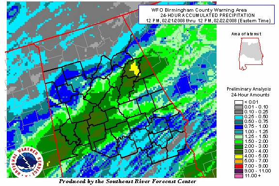
(Why it’s at an angle, I don’t know.)
Look at the huge strip of Alabama that received at least 1″ of rainfall…almost everywhere between Warrior and Montgomery (and points east and west)! Most areas from Livingston and Demopolis to Hoover to Anniston received at least 2″, with some locations over 3″. This is really a nice rain event…maybe the best soaking rain we’ve seen in a long time. You can just imagine the rain soaking into the ground, and running off into the lakes and rivers.
For a list of rainfall totals, scroll down to JB’s posts.



