


Things are really heating up to our west. Radars show two lines of strong thunderstorms from northern Mississippi into eastern Texas. Several severe thunderstorm warnings are in effect along this line.
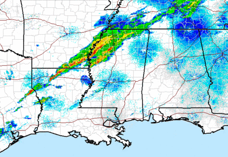
Meanwhile, the air over Mississippi and Alabama is becoming more unstable, with elevated CAPES approaching 2000 J/kg in southern MS, and dewpoints in the 60s now as far NE as Meridian. That moist, unstable air will continue to stream NE into Alabama over the next few hours, so the storms may actually intensify somewhat as they get closer.
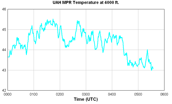
There is still a cap in place here in Alabama, and that will hopefully limit any storms from forming out ahead of the main line, which may not arrive in BHM until after 3 am. However, UAH MPR remote sensing of temperatures aloft indicate some cooling over the past few hours, so the cap could be weakening somewhat.
If you’re headed to bed, leave the WeatherRadio on. Otherwise, the blog crew will have updates through the night.



