


As a research guy, part of my job is to *try* to figure out what happened with the intense squall line and winds that came through early Tuesday morning. A fairly normal, non-severe squall line suddenly accelerated to speeds near 70 mph, and produced straight-line winds around 90 mph. It also produced 3 tornadoes, which is not surprising given the extreme wind shear along the squall line.
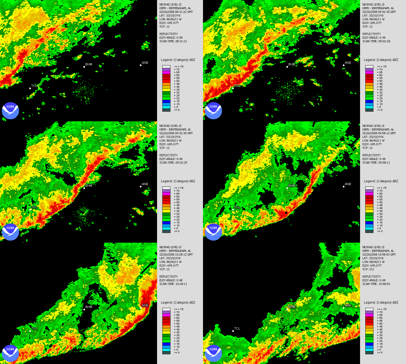
First of all, here is a look at a radar loop of the squall line from 230 am to 458 am. Notice how the line accelerates once it gets east of BHM. It makes it from BHM airport to Anniston in 47 minutes. Wow.
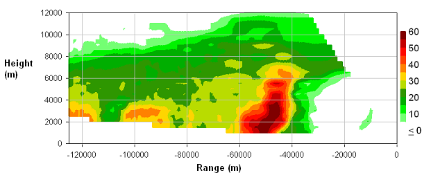
Taking a reflectivity cross-section through the line (looking at it from the side instead of from above, along a line to the NW of the radar) at 0915 UTC (315 am), one can see the intense part of the storm and how narrow it was. Notice also that it leans SE a little bit with height…the updraft was not allowing this heavy rain to fall out until it got further NW in the storm.
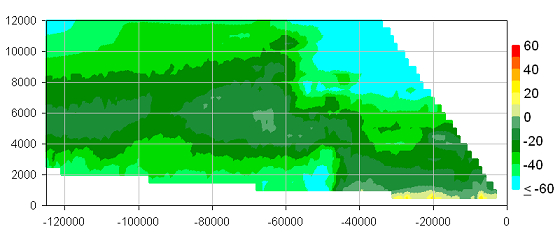
Looking at radial velocity (in knots), one can also see the gust front, or leading edge of the strong winds, indicated by the winds in excess of 50 knots near the ground, right behind the main line of reflectivity.
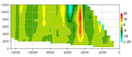
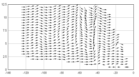
Using some old-time theory of wind flow, one can figure out the vertical motion (updraft and downdraft) given the horizontal winds. The updraft (red) and the downdraft (blue) both achieved speeds over 20 knots!
Finally, putting the horizontal and vertical winds together, we can draw vectors (arrows) showing the actual motion within the storm in the vertical cross section.
As far as why this squall line became so intense, we’re still working on it. Maybe there was some extra instability near BHM that helped it to intensify and accelerate. Maybe a low-level jet formed behind the main line and started pushing it, also bringing strong winds to the surface. Or, maybe the line got in phase with a large atmospheric wave, causing it to move faster and transport winds from aloft to the surface. With charts like these, we can look at these possibilities.



