


As James and JB pointed out last night, the models have been coming in a little more aggressive for accumulating snow in parts of northern, and maybe central Alabama, tonight. And the overnight model runs have continued this trend.
An upper-level disturbance will move across the area tonight, bringing another area of precipitation after a break in the precipitation today. As the atmosphere rapidly cools due to cold air moving in, upward motion, and precipitation, rain will change to snow across Mississippi this afternoon, then across parts of Alabama tonight.
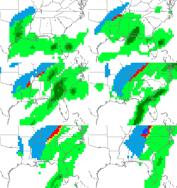
The models are in fairly good agreement that the atmosphere will become cold enough for snow in NW Alabama by 6 pm, and here in BHM by around midnight. Below is an animation of GFS-model predicted precipitation type (green is rain, blue is snow) every 3 hours starting at 9 pm last night and ending at 6 am Saturday. Notice this model shows some snow as far south as Greenville and Selma.
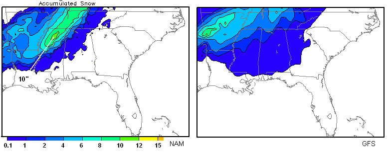
The models differ a lot on snow amounts. The storm totals are shown below. In both models, BHM receives 1/2″ to 1″, but on the NAM, parts of NW Alabama (north of a line from Hamilton to Florence) receive more than 2″. Notice the maximum snow near Oxford, MS, of 10-12″!
 .
The Canadian GEM is very aggressive. It shows possible 1-3″ snow as far south as BHM, and the UKMET shows only light amounts (less than 1″) in Alabama.
Obviously, this is another dynamic weather system, and the models are changing. We’ll have to see what the 12 UTC models show. NWS Huntsville is issuing a Winter Storm Watch, and BHM may do the same, especially for northwest counties.



