


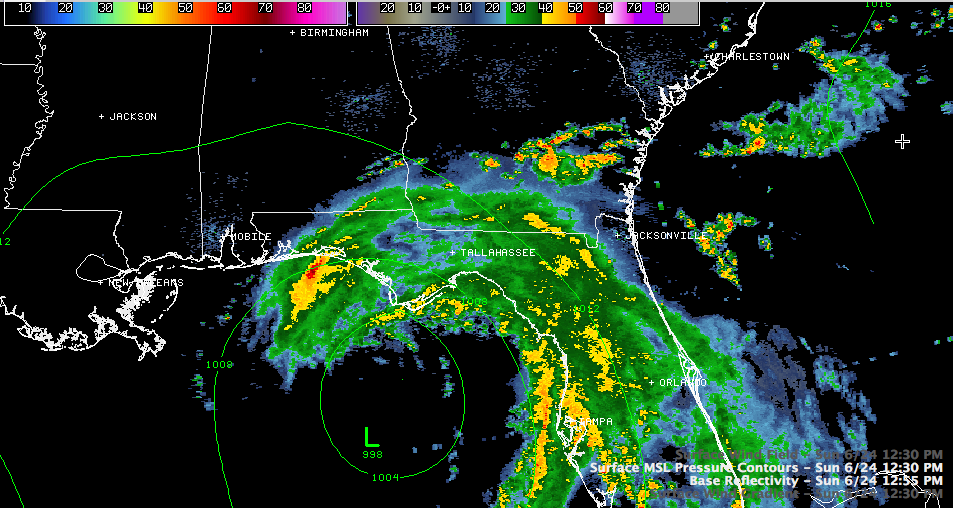
I think we will see major track changes in the official forecast from the National Hurricane Center at 4 p.m. this afternoon.
The Canadian has now come into line with the GFS’ thinking and is indicating a northeasterly motion for Debby. The European is coming in now. The GFS and European have been opposite in their output for the track of Debby in sort of a loser leave town smackdown of models. The Canadian has been waffling back and forth, but the GFS has been resolute in its northeast track depiction. This morning’s developments seem to be bearing that out, but it remains to be seen if that is a real trend.
LATE NOTE: The European is out to 78 hours now (Thursday). It shows the storm stationary until Wednesday and then coming ashore near Panama City.
1 PM ADVISORY INFO
Here is the 1 p.m. information on Debby from the National Hurricane Center.
SUMMARY OF 100 PM CDT…1800 UTC…INFORMATION
———————————————-
LOCATION…28.3N 85.9W
ABOUT 200 MI…325 KM ESE OF THE MOUTH OF THE MISSISSIPPI RIVER
ABOUT 105 MI…170 KM SSW OF APALACHICOLA FLORIDA
MAXIMUM SUSTAINED WINDS…60 MPH…95 KM/H
PRESENT MOVEMENT…NE OR 40 DEGREES AT 5 MPH…7 KM/H
MINIMUM CENTRAL PRESSURE…993 MB…29.32 INCHES
The Air Force recon flight found a maximum flight level winds of 78 mph in the northern quadrant of the storm at 12:05 p.m. The maximum surface winds were estimated at 61 mph according to the SMFR instrument on board.
Tropical storm warnings have been extended southward to the mouth of the Suwanee River. A tropical storm watch is now in effect south to Anclote Key. Tropical storm warnings continue for all of the Alabama and Northwest Florida coasts.



