


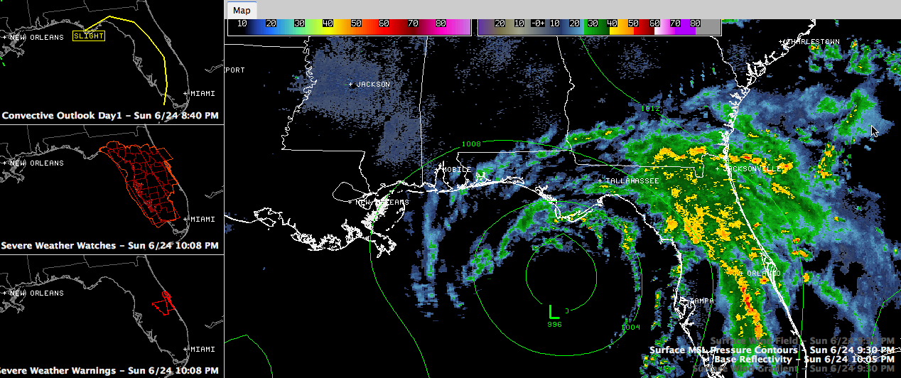
Debby is essentially stationary tonight.
The Air Force plane found the center just a little east northeast of the previous position.
Maximum flight level winds were 68 mph. The maximum surface winds were estimated was 46 mph. The not well organized, as evidenced by the fact that the two measurements were observed well away from the center. The minimum pressure observed was 992 mb. The advisory pressure was adjusted to 991 mb.
The disorganization is due to wind shear and dry air intrusion. The environment around the tropical cyclone will moisten back up over the next couple of days, and with Debby now expected to move only slowly north, some slight strengthening could occur in the next couple of days. Debby should remain below hurricane strength however.
The center of the cyclone should move inland near or just west of Panama City Friday morning. That means Debby will only move about 120 miles in five days!! The rainfall amounts will be astronomical. The HPC is calling for 23.7 inches near Panama City!
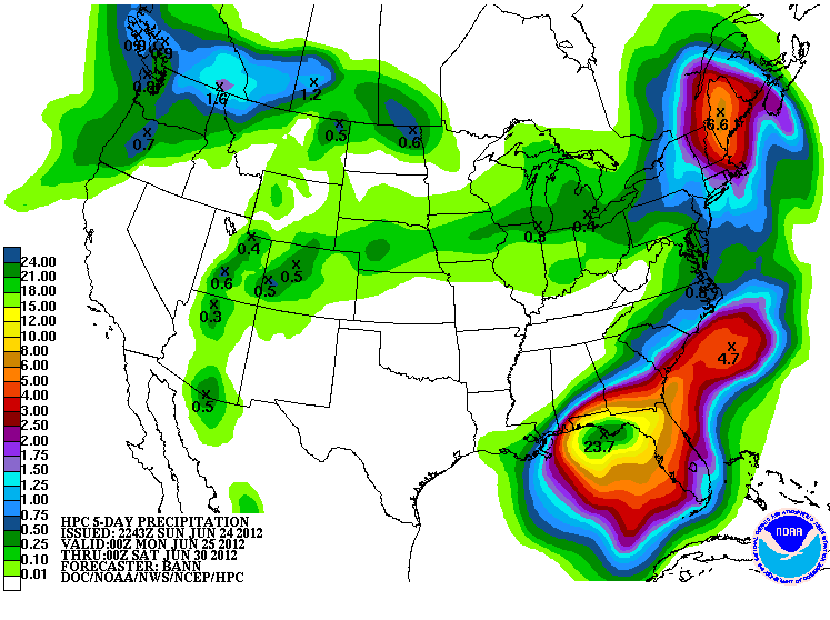
As you can see, the rainfall forecast is not good for Central Alabama. Areas south of I-85 will be the main benefactors. Drought stricken areas of northern Florida and southern Georgia will benefit immensely, if they don’t wash away.
SUMMARY OF 1000 PM CDT…0300 UTC…INFORMATION
———————————————–
LOCATION…28.3N 85.9W
ABOUT 110 MI…180 KM SSW OF APALACHICOLA FLORIDA
ABOUT 200 MI…325 KM ESE OF THE MOUTH OF THE MISSISSIPPI RIVER
MAXIMUM SUSTAINED WINDS…60 MPH…95 KM/H
PRESENT MOVEMENT…STATIONARY
MINIMUM CENTRAL PRESSURE…991 MB…29.26 INCHES



