


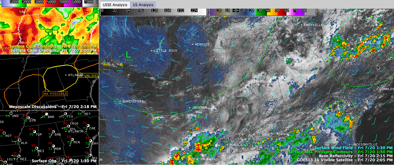
No, that’s not a crude rendering of the Olympic rings in the middle left panel on the graphic. (Click image to enlarge) That’s current mesoscale discussions in effect from the SPC.
Some clearing in the cloud deck over North Central Alabama could combine with deep moisture that is in place to provide fuel for storm development this afternoon. You can see that in the larger panel of the graphic. There are some pockets of decent instability that could create some strong storms in the next few hours. The current CAPE numbers are in the top left panel.
Note there is a little bit of a surface low near Memphis, as evidenced in the wind field barbs.
The SPC just mentioned this area in a mesoscale discussion, and put the chance that they would have to issue a severe thunderstorm watch at just 20%. This is because the coverage of storms is expected to only be isolated.
Still, we will keep an eye on things and have any updates right here through the afternoon and into the overnight.
Look at the temperature at Greenville MS. It’s up to 95F. The more widespread and stronger instability is certainly over the Magnolia State this afternoon. It is a prime area for storm development over the next few hours.



