


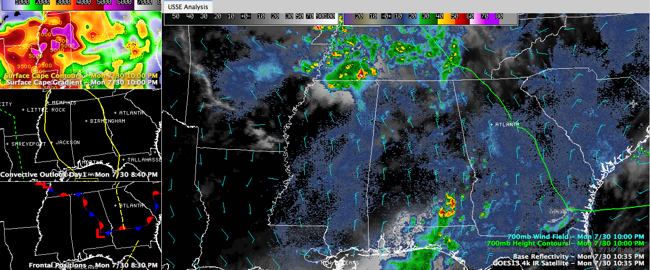
This graphic refers to several of the elements discussed in this post. Click the image to enlarge and study some of them. See how many you can find. Kind of a “hidden pictures puzzle” game like we used to enjoy in the Highlights magazines at the doctor’s office growing up.
You may have noticed that the SPC has at least part of all 67 Alabama counties in a slight risk severe weather outlook for the rest of the night. You might think that strange, but they have a reason.
Looking upstream, we see lots of showers and storms over western Tennessee and southeastern Missouri. I say upstream, because our upper level flow, which dictates where our weather will come from, is out of the northwest.
It is forming along a moisture and temperature boundary that extends northwest to southeast just to the north of the US-78 corridor. This activity will push into Northwest Alabama overnight.
There is still quite a bit of instability over eastern Mississippi and the northern half of Alabama tonight. And there is some decent shear as well. So there is a chance that the storms will intensify as they push into northeastern Mississippi and northwestern Alabama later.
So, after midnight, we may deal with some severe thunderstorms that will travel down the length of the state during the morning hours.
There is not good consensus among the short term models, so we will just have to see how it unfolds. The forecast is very low confidence. But we will be watching it right here. Set your Weatheradios and weather apps to alert you during the night in case any watches or warnings get issued. The threat will be from damaging wind gusts.



