


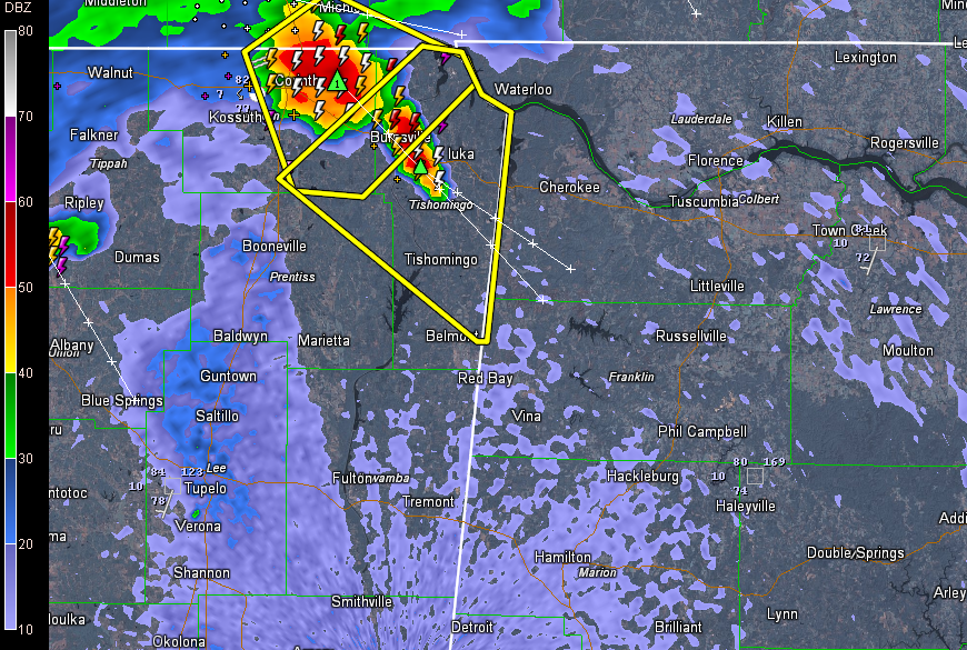
To our friends in Marion, Winston and Franklin Counties between now and 1 a.m.
Those are two nasty storms in northeastern Mississippi late tonight and they are tracking toward Northwest Alabama. And they seem to be getting stronger.
Severe thunderstorm warnings are in effect now in northeastern Mississippi. A slight risk severe weather outlook is in effect for virtually all of Alabama overnight.
The storms will reach Franklin County before midnight and Marion and Winston Counties before 1 a.m.
They could reach I-59 from Tuscaloosa perhaps to Birmingham by 3-4 a.m.
Damaging winds will be the main threat although there will be some large hail too.
Additional storms were developing further upstream and we could also deal with those through the early morning hours.
Don’t forget the torrential rains and deadly lightning as well.



