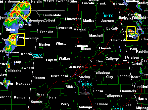
As of 3PM the Storm Prediction Center has placed parts of the coverage area under a slight risk of severe weather for the rest of today. There are developing thunderstorms in neighboring states that have reached severe limits. These storms are expected to move into the state as well as additional development is expected as the boundary layer continues to destabilize.
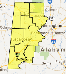
For this reason the Weather Service has issued a Severe Thunderstorm Watch for counties in West-Central Alabama. The counties included are Marion, Winston, Lamar, Fayette, Walker, Pickens, Tuscaloosa, Sumter, Greene and Hale. This watch will last until 10:00PM.
A check of the radar shows no activity over north-central Alabama, but thunderstorms are just across the Georgia and Mississippi state lines. These storms are producing hail, damaging winds, very dangerous cloud-to-ground lightning and flash flooding is possible.