


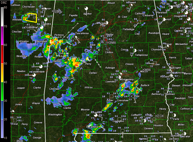
Showers and storms are increasing in coverage and intensity over West Central Alabama this afternoon.
They are heaviest from southern Pickens through Sumter and Greene into Hale and northern Marengo Counties.
They are producing lots of lightning and torrential rains. Greene and Hale Counties just went under an areal flood advisory. There could also be wind gusts to about 50 mph. Not seeing much indication of hail yet.
All of this activity should continue to slowly intensify as it pushes east southeast slowly.
Storms continue back into eastern Mississippi where we note one severe thunderstorm warning at this hour.
Other storms over South Alabama are building south of I-65.
Severe thunderstorm watch continues until 7 p.m. for much of Central Alabama.



