


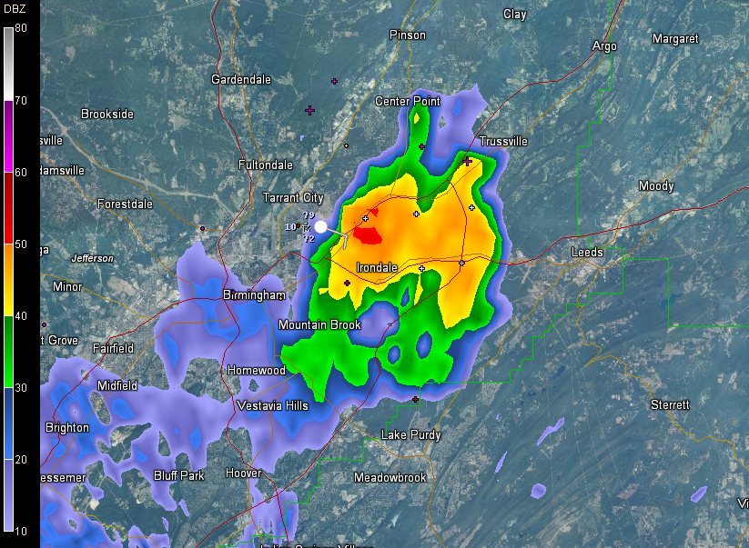
An isolated strong storm has been moving slowly across Jefferson County for the past 90 minutes or so.
It now extends from Woodlawn to Irondale out to Leeds and Trussville.
Lots of lightning and loud shaking thunder, as well as brief heavy rain and gusty winds, but it is not severe.
Moderate showers cover parts of West central Alabama at this hour, with heavier showers over northern Tuscaloosa, southern Walker and southeastern Fayette Counties.
The NWS has canceled the severe thunderstorm watch for Bibb, Dallas, Greene, Hale, Marengo, Perry, Pickens, Sumter and Tuscaloosa Counties.
According to the NWS, they canceled the watch for the western half of the counties due to that area already being worked over by earlier storms.
They continue the watch for Autauga, Chilton, Coosa, Elmore, Jefferson, Lowndes, Montgomery and Shelby Counties till 7:00 PM CDT.
They also say: Really the best threat for any severe activity will be Lowdnes, Montgomery, Elmore, and Coosa. May see this develop northward along the outflow moving east. In Coosa we may see a boundary collision soon and may increase the convection there as well. Will likely reduce the watch a few more counties after the top of the hour.



