


Line of storms came in a little faster than expected this morning. Right now, with the exception of the severe storm moving toward Cullman and Morgan counties…the line does not look too severe. However, south of the line, the sun is coming out. Take a look at the latest high-res visible satellite image from MSFC in Huntsville.
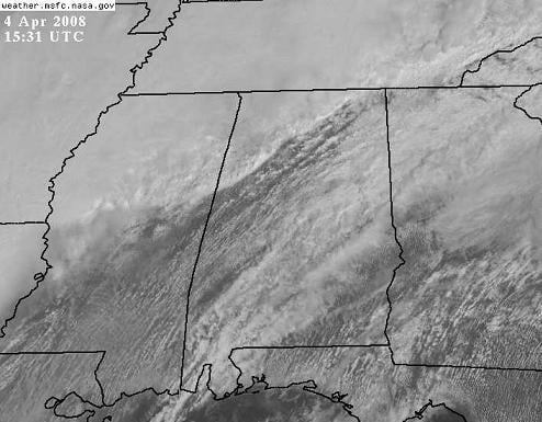
Temperatures over central Alabama are now in the mid 70s, withy dewpoints in the mid 60s. So, the line will be moving into more unstable air over the next couple of hours, and may intensify. In addition, a weak upper level wave will approach the area this afternoon, which may further enhance the storms.
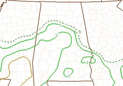
Combining shear and instability, the EHI (1-2 means possible tornadoes), is up to 2 south of I-20.
A tornado watch is in effect. Keep a source of weather information handy this afternoon.



