


Back to model hokey pokey.
Click image to enlarge
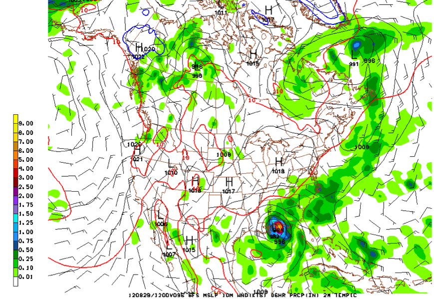
The morning run of the GFS has shifted the track for Isaac back to the west to near Mobile and Pensacola, and slows the system, delaying landfall until Wednesday morning.
We will continue to see shifts in individual model runs and somehow the NHC will resolve these into their track forecasts.
But it underscores the fact that everyone along the Mississippi, Alabama and Northwest Florida coasts (even New Orleans and Southeast Louisiana) still have to pay close attention to what this storm does. It will also likely be much stronger. I am afraid it could even become a category three hurricane now.
By Monday morning, Isaac will be over the southeastern Gulf of Mexico where warm water and low shear will create favorable conditions for strengthening. The size of the storm may be the only impediment to rapid intensification. The official forecast calls for 100 mph by early Tuesday, so 115 mph (the threshold for category three is certainly possible (maybe even higher).
DON’T TAKE ISAAC LIGHTLY: There is still little skill in forecasting intensity changes and while there aren’t indications there will be rapid intensification, the system is expected to slow and will be over some high oceanic heat content water. The morning GFS also swings it out a little further into the Gulf, taking it further away from Florida before the northward turn, meaning the opportunity to strengthen may be enhanced. So, Isaac could become a major hurricane.
PREPARATIONS: Hurricane watches will likely be issued late tomorrow for the northern Gulf Coast and hurricane warnings late tomorrow night or early Monday morning. Preparations should be finalized along the coast in the warning area by early Tuesday morning at the latest. Monday will be a big preparation and evacuation day. In fact, if you can do anything tomorrow, take care of it. Residents and interests along the coast should pay close attention to local media, local emergency management and advice from their local National Weather Service offices in case evacuation orders are issued.
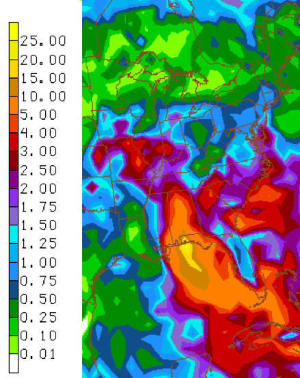
CENTRAL ALABAMA IMPACT: Impacts will depend on the track and speed of motion of Isaac. A slower northward motion will result in lesser winds over Central Alabama. Slower motion will also mean some big rainfall amounts. In this output from the GFS of rainfall over the next 7 days over South, widespread 5-10 inch amounts will fall over much of Alabama.



