


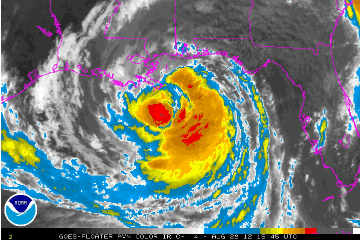
Isaac is now a hurricane according to data from the Hurricane Hunters. Data from the SFMR instruments onboard the aircraft showed hurricane force winds at the surface. The pressure is down to 975 mb.
Water levels are rising along the Gulf Coast to the north and northeast of our large, strong now category one hurricane.
REPORT FROM JACKSON COUNTY MS:
The following streets have been close due to inundation: Ocean Springs- Front Beach, East Beach, Hadstead Gust Park Estates- Kennter Street, Boat ramp at beach Pascagula- Magnolia St, Canty St/Dupont, Cedear Street @ Bridge, Beach Blvd, 4th st/Little St.
HURRICANE WARNING DROPPED FOR ALABAMA COAST
The hurricane warning was dropped for coastal Alabama. It extends now from the Alabama/Mississippi line to Morgan City. A tropical storm warning is in effect from the AL/MS line to Destin and west of Morgan City to Cameron. A tropical storm watch goes all the way to High Island TX.
The more westward watches and warnings are in response to the possibility that Isaac could continue west northwest along the coast with a landfall as far west as Lafayette Wednesday afternoon, moving to north of Beaumont TX by Thursday morning and into Northeast Texas early Friday morning. The GFS then takes it to east of Oklahoma City, to Kansas City, then north of St. Louis



